What is recorded here
From the National Monuments Service (Archaeological Survey of Ireland) record CO115-019
Places near here
Photo credits
- Maker not stated on source page, www.pinterest.com
- National Inventory of Architectural Heritage
- Andreas F. Borchert, Wikimedia Commons · CC BY-SA 4.0
- Golfing in Ireland; photographer not stated, Source publisher
- Picture: Sarah Walker Gallery
- Maker not stated on source page, www.tripadvisor.co.za
- Gordon Hatton, Geograph · CC BY-SA 2.0
- Maker not stated on source page, commons.wikimedia.org
- Maker not stated on source page, en.wikipedia.org
 Castle (in Ruins)Castle, unclassified · 638 yd
Explorer Tom Castle in Foildarrig is playing hard to get on that rocky outcrop. Legend says Dhermod McCarthy built it, but now…
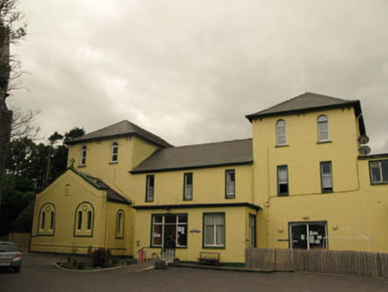 Harbour LodgeConvent/nunnery · 673 yd
Explorer Tom Harbour Lodge in Knockaneroe was a convent where nuns probably had tea with more flair than you do. Now it's a hostel…
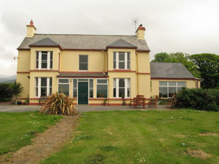 The Old PresbyteryHouse · 692 yd
Explorer Tom The Old Presbytery in Derrymihin West is perched on a hill overlooking the harbour. It’s got box bays and tripartite…
 Catholic Church of the Sacred HeartChurch/chapel · 715 yd
Explorer Tom Catholic Church of the Sacred Heart is doing its best to look important in Knockaneroe. It’s got stained glass by…
 MacCarthyPublic house · 823 yd
Explorer Tom MacCarthy in Knockaneroe is an imposing pub that survived some storm it probably bragged about later. The render…
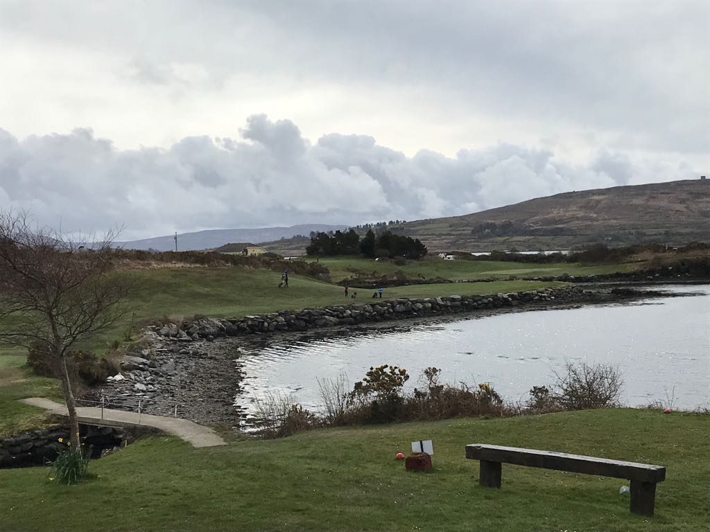 Berehaven Golf ClubGolf course · 847 yd
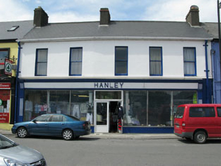 HanleyHouse · 860 yd
Explorer Tom Hanley in Knockaneroe is waiting for a prophecy that says it will turn into a gold mine, but so far it’s just managed…
 Sarah Walker GalleryGallery · 1066 yd
Explorer Tom Sarah Walker Gallery stands right on the pier at Castletownbere, where the harbour seems determined to join the…
 Standing stone in Derreenataggart EastStanding stone · 1125 yd
Explorer Tom Standing stone in Derreenataggart East is roughly square and leans slightly NE, pretending to be casual while standing…
 Dinish IslandIslet · 1266 yd
Explorer Tom Dinish Island in County Cork would bring a bottle of wine and a very bad playlist to any party it attended. It doesn’t…
 Cupmarked stone in Derreenataggart EastCupmarked stone · 1270 yd
Explorer Tom Cupmarked stone in Derreenataggart East has at least eight tiny cups on its smooth top, looking like a sad coin slot.…
 Droum CemeteryCemetery · 1752 yd
Explorer Tom Droum Cemetery in County Cork has a serious beef with that one big tree next door. It’s been shouting across the fence…
More archaeology and monuments in County Cork · All of County Cork

What do you know about this place?Tap to add a comment or ask a question