What is recorded here
Located in rough pasture at the head of a S-N valley, with the stream outside the perimeter at E. Marked only on the 1926 ed. of the OS 6-inch map. This is a large rectangular burial ground (dims. c 100m N-S; c. 80m E-W) defined by stone-clad field banks which is thought to have been used for the burial of famine victims. It was certainly used during the plague of 1867 (OS Name Books). A memorial dedicated to famine victims was erected in 1951 but there is little evidence of any burial. Archaeological testing (07E0064) on a site (dims. c. 140m NE-SW; c. 100m NW-SE), immediately to the SW, produced no archaeological material (Lynch 2010a).
Lynch, R. (2010a) Pulla. No archaeological significance. in I. Bennett (Ed.) Excavations 2007: summary accounts of excavations in Ireland, 519, No. 1837. Wordwell. Dublin.
The above description is derived from the published 'Archaeological Inventory of County Waterford' (Dublin: Stationery Office, 1999). In certain instances the entries have been revised and updated in the light of recent research.
Date of upload/revision: 6th October, 2011
Compiled by: Michael Moore
The monument record does not grant public access. Check the route and ask the landowner before entering private land.
- What survives
- Recorded monument
Places near here
 TobernabraherHoly well · 1675 yd
 Church in An Tseanchill (par. Dún Garbhán)Church · 1.8 mi
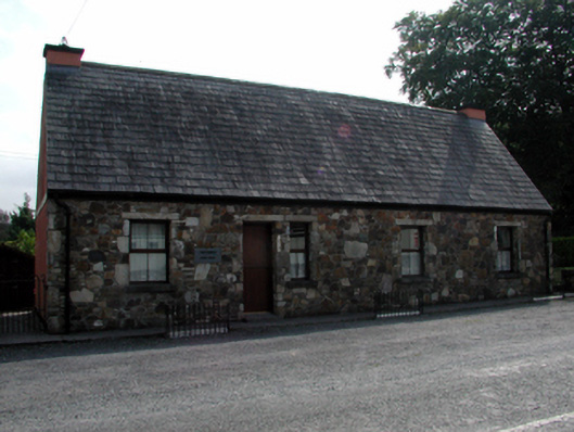 The Forgeforge/smithy · 1.8 mi
 St Michaels WellHoly well · 1.9 mi
 Castle (in ruins)Castle, unclassified · 2.0 mi
 CastleCastle, motte · 3.2 mi
 Cunnigar PointHeadland · 3.3 mi
 Waterford County MuseumMuseum · 3.3 mi
 Grattan SquareVisitor information · 3.3 mi
 Dungarvan World War I MemorialMemorial · 3.4 mi
 Dungarvan CastleCastle · 3.4 mi
 CarronadavdergMountain / peak · 3.9 mi