What is recorded here
In scrub. Marked 'Burial Ground' on OS 6-inch map (1842). Raised circular area (11m E-W; 15m N-S) defined by low scarp. Interior overgrown but some grave markers noted.
From the National Monuments Service (Archaeological Survey of Ireland) record CO104-004
The monument record does not grant public access. Check the route and ask the landowner before entering private land.
- What survives
- Recorded monument
Places near here
 garden temple1670 yd
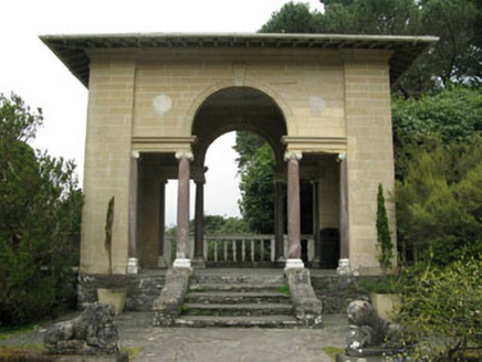 garden structure misc1736 ydBig PointHeadland · 1.0 mi
 GarinishIsland · 1.1 mi
 Garnish IslandIsland · 1.1 mi
 IlnacullinIsland · 1.2 miBryce HouseMuseum · 1.2 mi
 Glengarriff BayBay · 1.8 mi
 Glengarriff WoodsWood · 1.8 mi
 Gowlbeg MountainMountain / peak · 1.9 mi
 Derrynafulla swMountain / peak · 1.9 mi
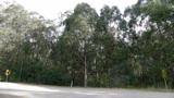 Tasmanian bluegum2.0 mi
Pictures: P L Chadwick, Geograph · CC BY-SA 2.0; National Inventory of Architectural Heritage; Ben Brooksbank, Geograph · CC BY-SA 2.0; Peter Clarke, Wikimedia Commons · CC BY-SA 3.0; Ben Brooksbank, Wikimedia Commons · CC BY-SA 2.0; Peter Craine, Wikimedia Commons · CC BY-SA 2.0; Colin Park, Geograph · CC BY-SA 2.0; John Tann from Sydney, Australia, Wikimedia Commons · CC BY 2.0
More archaeology and monuments in County Cork · All of County Cork
What do you know about this place?