What is recorded here
Medieval church ruins (LI029-107001-) stands in S quadrant of large rectangular-shaped graveyard (approx. dims. 68m N-S x 84m E-W) enclosed by a post 1700 stone wall with entrance gate in centre of W wall. C of I church stands immediately N of medieval church ruins in centre of graveyard. Concentration of memorials of post 1700 date in area S of medieval church ruins. Fewer burials in area to N of C of I church. Original graveyard appears to have been located to S of medieval church ruins with this building forming the N boundary of the graveyard which was later extended to the N when a new C. of I. church was built. The boundary of this smaller burial ground is depicted on the 1840 ed. OS 6-inch map.
Compiled by: Caimin O'Brien
Date of upload: 22 January 2019
The monument record does not grant public access. Check the route and ask the landowner before entering private land.
- What survives
- Recorded monument
Places near here
 Church (in ruins)Church · 9 yd
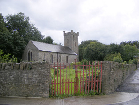 Ballingarry Churchchurch/chapel · 23 yd
 Holy well in CloontempleHoly well · 50 yd
 Johns WellHoly well · 528 yd
 Hachured (1923).Castle, motte · 563 yd
 Castle (in ruins)Castle, tower house · 1346 yd
 Famine stoneMemorial · 1.7 mi
 KnockfeerinaMountain / peak · 2.3 mi
 Lady's WellSpring · 2.8 mi
 Sunday WellSpring · 2.8 mi
 Flat cemetery in Kiltenan SouthFlat cemetery · 3.7 mi
 European ashEuropean ash · 4.1 mi