
Places near here
Photo credits
- National Inventory of Architectural Heritage
- Hywel Williams, Geograph · CC BY-SA 2.0
- Jonathan Thacker, Geograph · CC BY-SA 2.0
- The Speckled Bird, Wikimedia Commons · CC BY-SA 4.0
Explorer Tom Burial Ground in Doonpeter is playing hard to get. Mrs Clarke raised the walls around 1800 and found a cave, which I suspect was just a very confused badger's den. Keep an eye out for that bullaun stone!
Doonpeter Holy WellArchaeological place · 34 ydExplorer Tom Doonpeter Holy Well is an archaeological spot where the map makers definitely got it wrong, probably because they were drunk or just really bad at drawing circles. It’s basically a hole in the ground that thinks it can heal your soul, which is a tall order for something with no roof. Find the wonkiest bit and send it to your group chat.
 Coom BridgeBridge · 1266 yd
Explorer Tom Coom Bridge has two low stone arches that are just chilling over the Bride River since 1800. The stonemasons really outdid themselves with those neat voussoirs. It’s a quiet spot, perfect for pretending you’re a local farmer.
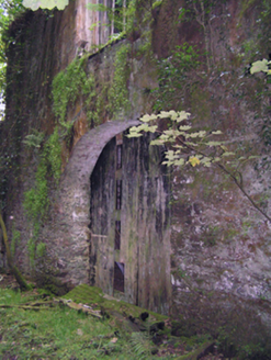 mill (water)1737 yd
Explorer Tom Mill in Glenville was run by Hudson-Kinahans and is now ruinous but still big on form and scale. The whole parish argued for weeks about who owned the mill race, and nobody won the argument.
Graveyard in GlenvilleGraveyard · 1.3 miExplorer Tom Graveyard in Glenville handles a nosey neighbour by pretending it’s just a pretty patch of grass with some interesting rocks, which is a classic deflection move. It’s got that shy personality where it wants to be seen but doesn’t want to commit to the spotlight. Bring biscuits, every good story needs biscuits.
Graveyard in Killuntin NorthGraveyard · 2.5 miExplorer Tom Graveyard in Killuntin North is just a circular outline on an old map, which means it’s basically a rumour with a fence. A man who saw the old graveyard described it as surrounded by an earthen fence, so he might have been hallucinating or just very imaginative. Have a chat with it, nobody's watching.
SeefinMountain / peak · 3.0 miExplorer Tom This Seefin is glaring at the new development site nearby, muttering about how things used to be done with proper stone and grit. It’s still wearing its old coat of heather like it hasn’t aged a day in decades. Go up there in good boots and better humour if you want.
 CorranMountain / peak · 4.4 mi
Explorer Tom Corran has an imaginary twin across the sea that it talks to every night via carrier pigeon, though none have ever returned. It believes its reflection in the clouds is actually the other one trying to steal its thunder and views. It's free, it's odd, so what more do you want really?
St John's WellSpring · 4.9 miExplorer Tom St John's Well has strict rules for visitors: no hats, no loud phones, and definitely no asking it if it knows where the parking is. It’s quite serious about that, really, dare you to say hello to it out loud and see if it gives you a wink or just stares blankly back.
Cappagh XViewpoint · 5.2 miExplorer Tom Cappagh X is where two families are having a silent feud over who owns the best view, probably involving a lot of shouting. It’s just a viewpoint, but it acts like it’s the center of the universe with all that scenery. Sit on a wall near it and pretend you're in a painting.
 Ballyhooly CastleCastle · 6.1 mi
Explorer Tom Ballyhooly Castle in County Cork is an early sixteenth-century tower house. You can see part of the bawn wall on the right if you look closely. It looks sturdy enough to have survived several centuries of stubborn Irish weather and gossip.
 Glanworth CastleCastle · 9.8 mi
Explorer Tom Glanworth Castle in County Cork is probably dreaming of being a grand mansion instead of just standing there looking slightly tired. It might have a hidden cellar full of old letters and gossip. Peek inside.
More archaeology and monuments in County Cork · All of County Cork

What do you know about this place?Tap to add a comment or ask a question