
What is recorded here
From the National Monuments Service (Archaeological Survey of Ireland) record CO071-040003
Places near here
Photo credits
- Maker not stated on source page, en.wikipedia.org
- Corkonian2013, Wikimedia Commons · CC BY-SA 3.0
- Frederick Dean, Geograph · CC BY-SA 2.0
- National Inventory of Architectural Heritage
- Sole Origami, Wikimedia Commons · CC BY-SA 4.0
- Maker not stated on source page, tr.pinterest.com
- Maker not stated on source page, it.pinterest.com
- Maker not stated on source page, www.pinterest.com
- Maker not stated on source page, commons.wikimedia.org
- Jo and Steve Turner, Geograph · CC BY-SA 2.0
 Church (Remains of)Church · 18 yd
Explorer Tom Church (Remains of) in Carrigathou is currently obscured by dumped field-fence material, which is the ultimate insult…
 Mullinhassig WoodWood · 936 yd
Explorer Tom Mullinhassig Wood hides a waterfall beside the Glashagarriff River, a few kilometres from Coachford, and its Irish name…
 Mullinhassig WaterfallWaterfall · 984 yd
Explorer Tom Mullinhassig Waterfall hides in a small Cork woodland near Coachford, where the Glashagarriff River cuts between rock…
 Oakpark HouseCountry house · 1595 yd
Explorer Tom Oakpark House in Coolnagearagh ended up in the wrong place after a fire, so it rebuilt itself with Gothic Revival style…
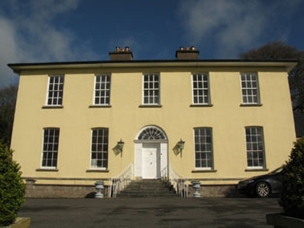 Aghavrin HouseHouse · 1.1 mi
Explorer Tom Aghavrin House is so symmetrical it makes me dizzy, with chimneystacks that look like they're trying to punch the sky.…
 St John the Baptist ChurchOfficially recorded historic building · 1.2 mi
Explorer Tom St John the Baptist Church was nearly sold for a horse because someone thought the pinnacles were decorative horse…
 Wet WoodWood · 1.4 mi
Explorer Tom Wet Wood would use its entire lotto win to buy a giant umbrella that covers the whole place just so it never has to…
 Fairy fort / earthen ringfort in CoolgarriffFairy fort / earthen ringfort · 1.4 mi
Explorer Tom This huge Fairy fort / earthen ringfort in Coolgarriff was 200 feet across back in the day! Now it’s levelled and…
 Anomalous stone group in CoolgarriffAnomalous stone group · 1.4 mi
Explorer Tom Anomalous stone group in Coolgarriff was three stones forming a triangle, one standing upright at the apex. Now there’s…
 Canovee GAA pitchGAA ground · 1.4 mi
 Carrigadrohid CastleHeritage attraction · 1.5 mi
Explorer Tom Carrigadrohid Castle in County Cork is playing hard to get, like it’s waiting for a really good deal on its own walls.…
 Carrigadrohid Castle (in Ruins)Castle, tower house · 1.5 mi
Explorer Tom Carrigadrohid Castle is standing in water because someone decided to build a dam nearby. It's basically an island now…
More archaeology and monuments in County Cork · All of County Cork

What do you know about this place?Tap to add a comment or ask a question