What is recorded here
From the National Monuments Service (Archaeological Survey of Ireland) record GA045-056
Places near here
Photo credits
- Maker not stated on source page, uk.pinterest.com
- Didier Descouens, Wikimedia Commons · CC BY-SA 4.0
- liam murphy, Geograph · CC BY-SA 2.0
- Maker not stated on source page, commons.wikimedia.org
- Maker not stated on source page, www.pinterest.com
- Maker not stated on source page, www.dreamstime.com
- Maker not stated on source page, www.irishcentral.com
- National Inventory of Architectural Heritage
 Bullaun stone in MountsilkBullaun stone · 220 yd
Explorer Tom Bullaun stone in Mountsilk would order a massive portion of chips and extra sauce without blinking. It’s been waiting…
 Hawthorn1.2 mi
Explorer Tom This Hawthorn in County Galway has an imaginary twin across the sea who keeps sending it bad poetry and terrible…
 Moylough Castle (in ruins)Castle, hall-house · 1.2 mi
Explorer Tom Moylough Castle is basically a giant rabbit hutch that forgot to invite any actual rabbits. The local burrows think…
Moylough CastleCastle · 1.2 miExplorer Tom Moylough Castle in County Galway keeps getting picked on by the wind, which seems to think it can finally blow the…
 Fairy fort / earthen ringfort in Mullaghmore East,mullaghmore NorthFairy fort / earthen ringfort · 1.2 mi
Explorer Tom Fairy fort / earthen ringfort in Mullaghmore East, Mullaghmore North has a secret it would tell after a few pints…
 Fairy fort / earthen ringfort in Mullaghmore NorthFairy fort / earthen ringfort · 1.2 mi
Explorer Tom Fairy fort / earthen ringfort in Mullaghmore North has a secret talent for disappearing without leaving so much as a…
 Moylough CemeteryCemetery · 1.2 mi
Explorer Tom Moylough Cemetery in County Galway has strict rules for visitors, mostly involving not stepping on the graves or making…
 Holy Trinity ChurchChurch · 1.3 mi
Explorer Tom Holy Trinity Church in Moylough More has some serious foundation issues, or maybe just low self-esteem. A bad poem once…
 Cross-inscribed stone in GorteenlahardCross-inscribed stone · 1.3 mi
Explorer Tom Cross-inscribed stone in Gorteenlahard was supposedly in a children's burial ground but vanished before anyone could…
 Fairy fort / earthen ringfort in GorteenlahardFairy fort / earthen ringfort · 1.3 mi
Explorer Tom Fairy fort / earthen ringfort in Gorteenlahard has a hollow that might be a footprint or just a cow taking a nap. Local…
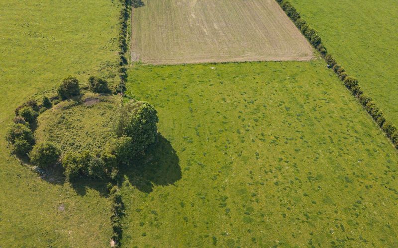 Fairy fort / earthen ringfort in Gortaganny (coolcoo Ed)Fairy fort / earthen ringfort · 1.3 mi
Explorer Tom Fairy fort / earthen ringfort in Gortaganny is overgrown and subcircular. The outer bank only survives from NE to E…
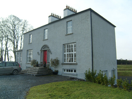 SummervilleRectory/glebe/vicarage/curate's house · 1.3 mi
Explorer Tom Summerville is a rectory that has a permanent feud with the rain. It’s a Georgian gem that probably complains about…
More historic places in County Galway · All of County Galway

What do you know about this place?Tap to add a comment or ask a question