
What is recorded here
In rough hill pasture, on a terrace of a S-facing slope. This structure, which is 18th/19th-century in date, consists of two straight drystone walls situated at right angles to each other. The E-W wall (L 6.75m; T 0.65m; H 1.8m) has a closed-up doorway (Wth 0.75m) 2m from its W end. The N-S wall (L 4m; T 0.65m; H 1.8m) joins the E-W wall, at its S end. A mound (Wth 1.2m; H 1.6m) of loose stones abuts the W side of the N-S wall. The interior is cut into the upslope on the NW side. Loose stones are scattered around the interior and exterior. A sheep path skirts the S side.
Compiled by: Elizabeth Byrne, Ursula Egan and Sheila Ronan, Archaeological Survey Unit, University College, Cork.
Date of upload: 30 May 2011
The monument record does not grant public access. Check the route and ask the landowner before entering private land.
- What survives
- Recorded monument
Places near here
 Inchee Br.Bridge · 693 yd
 Structure in Coolnagoppoge (glanarought By., Banawn Ed)Structure · 1.6 mi
 Enclosure in Coolnagoppoge (glanarought By., Banawn Ed)Enclosure · 1.8 mi
 Coomagearlahy W TopMountain / peak · 2.0 mi
 An Coimín BuíMountain / peak · 2.1 mi
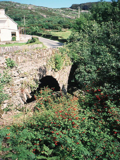 Morley's Bridgebridge · 2.3 mi
 Sli Gaeltacht MuscraiWalking route · 4.6 mi
 Kilgarvan Motor MuseumMuseum · 4.7 mi
 Hidden Valley Pet FarmHeritage attraction · 4.7 mi
 Great Southern & Western RailwayMemorial · 4.7 mi
 Battle of Callannbattle · 4.8 mi
 European ashEuropean ash · 5.0 mi
Other information
Photo: Credit not shown in the picture search · Rights wording not checked; contact us if this picture should be removed