What is recorded here
Places near here
Photo credits
- National Inventory of Architectural Heritage
- Kenneth Allen, Geograph · CC BY-SA 2.0
- Anne Burgess, Wikimedia Commons · CC BY-SA 2.0
- Kenneth Allen, Wikimedia Commons · CC BY-SA 2.0
- Eric Jones, Geograph · CC BY-SA 2.0
- A McCarron, Wikimedia Commons · CC BY-SA 2.0
- Joseph Mischyshyn, Wikimedia Commons · CC BY-SA 2.0
Explorer Tom An tOileán Dubh looks like it's had a bad day and needs a drink, sitting lonely in County Donegal. Tell it a joke, it's been a long time since anyone did and it might laugh out loud.
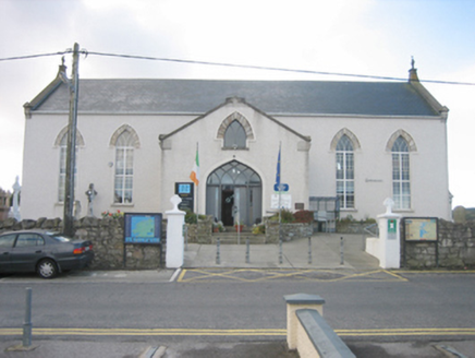 Ionad Teampeall ChróineChurch/chapel · 1383 yd
Explorer Tom Ionad Teampeall Chróine is a cruciform-plan church from c. 1855-6 that’s now trading its pews for library shelves and heritage displays. It was built by local parishioners who literally raised the stones themselves, which is a level of dedication that really sets it apart. Now that it’s a tourist office, you can peek inside and see how they managed to keep those Celtic cross finials looking so sharp despite the change of use.
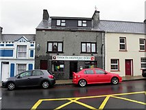 Teach Owenie BánPub · 1391 yd
Explorer Tom Teach Owenie Bán in Dungloe has a sign that’s falling off the wall, which is very on-brand for the pub. The Irish name is fancy, but the pints are likely mediocre. Keep an eye out for ghosts.
 Mulhern’s Corner BarPub · 1393 yd
Explorer Tom Mulhern’s Corner Bar sits right on Lower Main Street, looking down its nose at everyone else. The corner is probably sharp enough to cut your cheek. Ask if they have any stories about the wall.
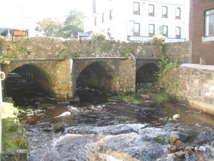 bridge1410 yd
Explorer Tom Bridge in Dunglow has three arches that look like they’re wearing very serious stone smiles! Built around 1760, I wonder if the masons practiced their grins before setting each block. It feels like a river gatekeeper who’s been holding its breath for centuries.
 CroaghnamaddyMountain / peak · 3.1 mi
Explorer Tom Croaghnamaddy in County Donegal is basically just a very arrogant hill that thinks it's a mountain. I'd bet my last pint there's a secret bakery up there, so bring biscuits, every good story needs biscuits.
 Cairn, LoughanurePublicly named cairn · 3.8 mi
Explorer Tom Cairn, Loughanure is a place where the name suggests a connection to water and perhaps a specific local story. I imagine it’s one of those spots that has been part of the landscape for a long time, maybe used by people who lived nearby. It’s a name that makes you think about how places get their names.
 Drumlaghdrid HillMountain / peak · 3.8 mi
Explorer Tom Drumlaghdrid Hill stands in County Donegal with its access details currently unknown. A photograph shows the B7905 road climbing south-eastwards across its flank, six kilometres north of Lettermacaward. It is a bit cheeky for a hill to have such a well-documented road climbing up its side while still keeping its own path a secret!
 Lough Aghnish Promontory FortPromontory fort, inland · 4.1 mi
Explorer Tom Lough Aghnish Promontory Fort cuts off a peninsula with a stone wall that has a weird, angled entrance. The base is solid, but the top looks like modern repairs. It’s a bit of a puzzle why they built it exactly there.
 Inis Mhic an DoirnIsland · 4.8 mi
Explorer Tom Inis Mhic an Doirn has that 'don't touch' energy radiating off it like Wi-Fi. There’s a derelict building nearby that looks haunted by bad decisions. Mind the nettles, they're the real guards here and they bite back.
Crolly WaterfallWaterfall · 5.0 miExplorer Tom Crolly Waterfall is recorded as a waterfall in Donegal after rain, which is vague but poetic. We don’t know much else, so let’s make up a legend about a crying witch. Look for the ghost, then pretend you didn't see anything weird.
Hook Point / Pointe an DuáinHeadland · 5.2 miExplorer Tom Hook Point makes a weird humming sound at night that sounds like a tuba falling down stairs. It’s quite embarrassing for the whole headland, really. Bring your worst joke, because this place has definitely heard worse.
More islands in County Donegal · All of County Donegal

What do you know about this place?Tap to add a comment or ask a question