Places near here
Photo credits
- National Inventory of Architectural Heritage
- EecherplazGinkgo06.jpg : Cayambe derivative work: Ginkgotree ( talk ), Wikimedia Commons · CC BY-SA 3.0
- Mike Searle, Wikimedia Commons · CC BY-SA 2.0
- Kieran Campbell, Geograph · Creative Commons Attribution-ShareAlike 2.0
- Andreas F. Borchert, Wikimedia Commons · CC BY-SA 4.0
- Eric Jones, Wikimedia Commons · CC BY-SA 2.0
- Brian Shaw, Wikimedia Commons · CC BY-SA 2.0
- Robin Pollard, Wikimedia Commons · CC BY 3.0
- Malene Thyssen, Wikimedia Commons · CC BY-SA 3.0
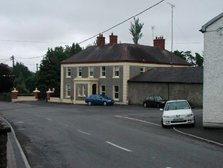 Riverview HouseHouse · 44 yd
Explorer Tom Riverview House in Cloghanstown looks like it was built by someone who really loved their tea and wanted the house to remember every single cup ever poured. The rendered decoration is so extensive it's basically wearing a patterned scarf that refuses to come off. Don't touch the porch, it bites!
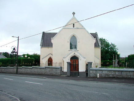 Saint Brigid's Catholic ChurchChurch/chapel · 122 yd
Explorer Tom Saint Brigid's Catholic Church has a name that sounds like a bad hairdo, but it’s actually a 1834 classic T-plan chapel. It’s got a cast-iron belfry that rings out over Raharney, and I bet the bells are judging your outfit. Keep an eye out for that iron frame.
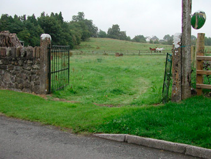 gates/railings/walls165 yd
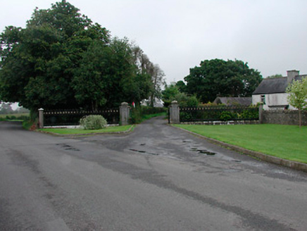
Explorer Tom Gates in Balrath are the escape plan of its first owner, who probably slipped out when he heard the church bell ring and never looked back. They’re simple vernacular gates that are now rare because everyone else ripped theirs out for tractors, so these guys think they’re basically rock stars by comparison. Give them a nod if you see them.
 Grange More HouseGates/railings/walls · 221 yd
Explorer Tom Grange More House gates are the result of a family feud where everyone agreed the view was nice but nobody could agree on who owned it. The ironwork is so fancy it probably has a personal stylist and a therapist. If you look closely, you can see the clenched fists of history judging your footwear.
 Ginkgo4.3 mi
Explorer Tom Ginkgo in County Westmeath has a favourite song that is just the wind rustling through its fan-shaped leaves in a very rhythmic way. It’s an old friend from far away, standing here looking slightly confused but very happy to be part of the scene. Have a nosey, politely.
_-_geograph.org.uk_-_2494736.jpg/250px-Castles_of_Leinster,_Martinstown,_Westmeath_(2)_-_geograph.org.uk_-_2494736.jpg "Photo: Mike Searle, Wikimedia Commons · CC BY-SA 2.0") Martinstown Castle in RuinsCastle, tower house · 4.6 mi
Martinstown Castle in RuinsCastle, tower house · 4.6 miExplorer Tom Martinstown Castle in Ruins is playing hard to get on that rock outcrop. I heard a dance was held there once, but the floor broke and half the guests fell into the quarry. Bring a coin for luck and keep it in your pocket.
 Fairy fort / earthen ringfort in ReynellaFairy fort / earthen ringfort · 4.7 mi
Explorer Tom Fairy fort / earthen ringfort in Reynella thinks the local sheep are just overgrown dogs that haven’t learned to bark yet. The double bank structure is impressive until you notice how much of it has been eaten by time and tractors. Linger, it's not going anywhere and neither should you.
 Font (present location) in TowlaghtFont (present location) · 5.9 mi
Explorer Tom Font in Towlaght was moved from an old church to St Finian's in 1991. It’s carved with biblical scenes and looks like it has seen better days. It's free, it's odd, what more do you want?
 Delvin CastleVisitor attraction · 6.0 mi
Explorer Tom Delvin Castle has been locked in a bitter, centuries-long feud with the rain, and honestly, the castle is winning. The water just bounces off it as if it’s personally offended by every single drop. Bring a flask of something warm and a story to swap.
 CastleCastle, tower house · 6.0 mi
Explorer Tom Castletowndelvin Castle is a tower house that thinks it’s a hall-house, which is a bit like wearing a tuxedo to the beach. It’s got corner towers that look smug enough to charge rent. Stand where the owner stood and practise looking smug.
.jpg/250px-Croppies_Grave_Clonard_-_panoramio_(1).jpg "Photo: Robin Pollard, Wikimedia Commons · CC BY 3.0") Croppies' GraveMemorial · 7.1 mi
Croppies' GraveMemorial · 7.1 mi European Beech7.1 mi
Explorer Tom European Beech in County Meath is sick of people asking if it talks to the other trees; yes, they gossip, shut up. It’s got that tired look of someone who’s heard every question before. Bring a flask of something warm and a story to swap.
More historic places in County Westmeath · All of County Westmeath

What do you know about this place?Tap to add a comment or ask a question