
What is recorded here
Nine-arch road bridge, built c.1800, spanning the Sullane River. Round-headed arches with dressed limestone voussoirs, having pair of camber-headed arches to western spans with tooled limestone voussoirs and keystones. Dressed rubble stone soffits throughout, springing from rubble stone piers with V-cutwaters to both…
Read the whole record
Nine-arch road bridge, built c.1800, spanning the Sullane River. Round-headed arches with dressed limestone voussoirs, having pair of camber-headed arches to western spans with tooled limestone voussoirs and keystones. Dressed rubble stone soffits throughout, springing from rubble stone piers with V-cutwaters to both elevations. Rubble stone spandrels and parapets with rubble stone to blocked westernmost span and solider stone capping to parapets. Recent corbelled conical bartizans with wrought-iron railings to south elevation of parapets with dressed over-sailing rubble stone corbels. Weir to downstream elevation.
The irregular size and shape of this bridge's arches is unusual and may indicate multiple phase construction which included the creation of a mill race for the nearby mill to the north. The use of varied stone finishes adds textural interest. Located immediately west of the town centre, the bridge is an important crossing point over the Sullane River.
From the Buildings of Ireland (National Inventory of Architectural Heritage) record 20852015
Places near here
Photo credits
- Garry Dickinson, Wikimedia Commons · CC BY-SA 2.0
- National Inventory of Architectural Heritage
- Richard Fensome, Geograph · Creative Commons Attribution-ShareAlike 2.0
- Donald MacDonald, Geograph · CC BY-SA 2.0
- Joebater at English Wikipedia, Wikimedia Commons · CC BY-SA 3.0
- Maker named on the Wikimedia Commons picture page · CC BY-SA 2.5
- me, Wikimedia Commons · Public domain
- Jonathan Thacker, Geograph · CC BY-SA 2.0
- Ceoil at English Wikipedia, Wikimedia Commons · CC BY-SA 3.0
- Gordon Hatton, Wikimedia Commons · CC BY-SA 2.0
- Jonathan Thacker, Wikimedia Commons · CC BY-SA 2.0
_-_geograph.org.uk_-_6529588.jpg/250px-Castles_of_Munster,_Macroom,_Cork_(1)_-_geograph.org.uk_-_6529588.jpg "Photo: Garry Dickinson, Wikimedia Commons · CC BY-SA 2.0") Macroom CastleCastle · 76 yd
Macroom CastleCastle · 76 yd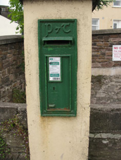 post box89 yd
 Saint Colman's Church (Macroom)Church/chapel · 104 yd
 Macroom Castle (in Ruins)Castle, tower house · 108 yd
Explorer Tom Macroom Castle was demolished in 1967 to build a technical school. Smith described two square towers, but now it’s just history. Take a picture of the modern building instead.
 Battle of MacroomBattle · 452 yd
 Sessile Oak1.3 mi
 The Gearagh Nature ReserveNature reserve · 2.3 mi
 Kilmurry WoodsPicnic place · 5.3 mi
 Carrigagulla Stone CircleArchaeological place · 6.8 mi
 KnocknakillaArchaeological place · 7.4 mi
 Kilmichael Ambush SiteMonument · 7.6 mi
 MusheraMountain / peak · 8.0 mi
More historic places in County Cork · All of County Cork

What do you know about this place?Tap to add a comment or ask a question