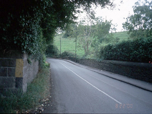
What is recorded here
From the Buildings of Ireland (National Inventory of Architectural Heritage) record 11362057
Places near here
Photo credits
- National Inventory of Architectural Heritage
- Laurel Lodged, Wikimedia Commons · CC BY-SA 4.0
- JP, Geograph · CC BY-SA 2.0
- Mike Murphy ( talk · contribs ), Wikimedia Commons · CC BY-SA 3.0
- Carroll Pierce, Wikimedia Commons · CC BY-SA 2.0
- Pier Paolo Lisarelli, Wikimedia Commons · CC BY-SA 4.0
- N Chadwick, Geograph · CC BY-SA 2.0
- JP, Wikimedia Commons · CC BY-SA 2.0
- Harold Strong, Geograph · CC BY-SA 2.0
Explorer Tom Rag Well in Diswellstown gets its name from hanging cloth there after bathing eyes. The well is now covered over with a pump, so the rags have nowhere to go. Get there early and have it all to yourself.
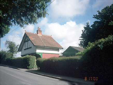 Willow CottageHouse · 175 yd
Explorer Tom Willow Cottage looks like a gate lodge's little sister, wearing terracotta tiles and chamfered corners. It refuses to fall down because it's too proud to admit it's tired. It's the kind of place that makes a dull Tuesday interesting without trying too hard.
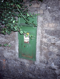 post box183 yd
Explorer Tom Post box in Castleknock is stuck in a limestone wall at a crossroads. It looks lost, like it doesn’t know where the mail should go. Built in 1920, it’s just waiting for someone to notice.
 Castleknock CastleCastle · 512 yd
Explorer Tom Castleknock Castle in County Dublin is perched right on top of a big old mound, just showing off. It's next to a college, so maybe the students are living in ghost stories now?
 The Royal Canal WayWalking route · 1494 yd
Explorer Tom The Royal Canal Way in County Dublin is stuck near Castleknock. The water looks lazy, so I’m betting the path is too. Drop a shot of that lock for my album!
 Oldtown WoodWood · 1.6 mi
Explorer Tom Oldtown Wood in County Dublin gives a glimpse of the 'Fifteen Acres' and mountains. Sounds like a real estate listing. Probably beautiful though. Take a picture of the gap, not just the trees.
 Giant Sequoia1.8 mi
Explorer Tom Giant Sequoia in County Dublin is having an existential crisis because it has an imaginary twin across the sea it’s never met. It’s huge, loud, and completely out of place here, like a giant in a small room. Look for the ghost, then pretend you didn't see anything weird.
 Hermitage ParkPark · 1.8 mi
Explorer Tom Hermitage Park in County Dublin is where the locals go to be left alone, but they're not very good at it. No records? I bet there's a hermit who actually enjoys the company. Say hi!
 Knockmaree DolmenArchaeological place · 1.9 mi
Explorer Tom Knockmaree Dolmen in County Dublin is having a nap under its giant stone blanket. It’s been snoozing for ages, dreaming about ancient farmers. Wake it up gently if you dare!
 Phoenix Park Visitor CentreVisitor information · 1.9 mi
Explorer Tom Phoenix Park Visitor Centre in County Dublin is right by Ashtown. The caption says it's there, so I believe it. Take a picture for me and tell the park rangers I said hello on their behalf!
 Dunsink ObservatoryHeritage attraction · 2.1 mi
Explorer Tom Dunsink Observatory has been staring at the stars since 1783 and getting absolutely no replies. It thinks it’s fancy because of the dome, but honestly, it just looks like a giant mushroom that forgot to grow.
 Church, GraveyardChurch · 2.2 mi
Explorer Tom Church in Clonsilla, County Dublin has had so many names it's getting confused. The land has history going back to 500AD, which is older than some of us are old. Bring your nan, she'll know more than me.
More historic places in County Dublin · All of County Dublin

What do you know about this place?Tap to add a comment or ask a question