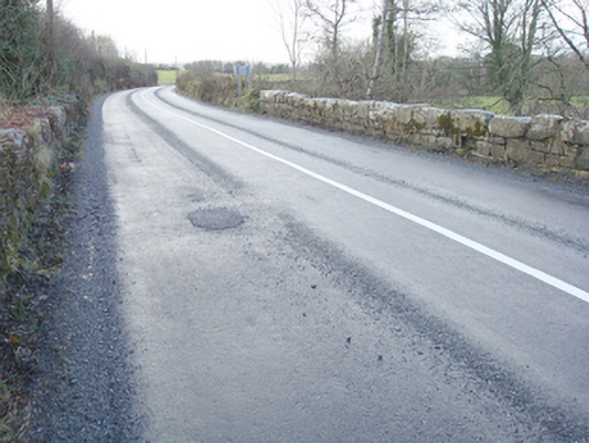
What is recorded here
Triple-arched bridge carrying road over the River Lurgy, built c. 1820, having V-profile coursed rubble stone cutwater to piers. Round-headed arches having dressed cut stone voussoirs. Coursed rubble stone construction to pier and spandrels. Rubble stone parapets with field stone coping over. Located in the rural countryside to the north-east of Kilmacrenan.
This appealing and elegant triple-arched road bridge retains much its early character and form, and is an appealing feature in the landscape to north-east of Kilmacrenan. This bridge is robustly-constructed in local coursed rubble stone masonry, and its continued survival and use stands as testament to the quality of its original construction, and of the skill of the masons involved. The small round-headed arches with dressed stone voussoirs and the coursed rubble stone cutwaters are features of some appeal that help to elevate this bridge above many of its contemporaries in Donegal. The field stone coping over the parapets creates a picturesque feature of some rustic charm. The form of this bridge suggests that it dates to the end of the eighteenth century or to the very start of the nineteenth century, a period that witnessed a large expansion in the rural road network in Ireland - and the subsequent building of numerous bridges - which was mainly carried out by the Grand Juries (the forerunners of the County Councils). This appealing rustic bridge is an integral element of the built heritage and transport heritage of the local area, and makes a positive contribution to the local landscape.
From the Buildings of Ireland (National Inventory of Architectural Heritage) record 40822006
This does not grant access. Most recorded buildings are privately owned; view them only from public ground unless the owner allows entry.
Places near here
Photo credits
- Andreas F. Borchert, Wikimedia Commons · CC BY-SA 4.0
- National Inventory of Architectural Heritage
- Kenneth Allen, Wikimedia Commons · CC BY-SA 2.0
- Chris Gunns, Wikimedia Commons · CC BY-SA 2.0
- Percita at Flickr, Wikimedia Commons · CC BY-SA 2.0
- Heikki.vesanto, Wikimedia Commons · CC BY-SA 4.0
- Patrice78500, Wikimedia Commons · CC BY-SA 3.0
- Akira7ink, Wikimedia Commons · CC BY-SA 4.0
- Kenneth Allen, Geograph · CC BY-SA 2.0
- Me, Wikimedia Commons · Public domain
 Kilmacrenan FriaryReligious house, Franciscan Third Order Regular · 580 yd
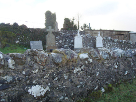 Kilmacrenan Old ChurchChurch/chapel, graveyard/cemetery · 656 yd
 Aghawoney Standing StonesPublicly named standing stone · 2.0 mi
 Doon Rock FortPromontory fort, inland · 2.2 mi
 Silver Birch2.3 mi
 Ballyarr Nature ReserveNational nature reserve · 2.4 mi
.JPG/250px-Lough_Salt_Mountain_(469m).JPG "Photo: Patrice78500, Wikimedia Commons · CC BY-SA 3.0") Loughsalt MountainMountain / peak · 3.5 mi
Loughsalt MountainMountain / peak · 3.5 mi Master Sword in StoneHeritage attraction · 4.7 mi
 Tullyaughnish Old Church GraveyardGraveyard · 4.8 mi
 Gregory HillMountain / peak · 5.8 mi
 Stackarnagh Abbey GraveyardGraveyard · 6.0 mi
 Battle of ScarrifholisBattle · 7.3 mi
More historic places in County Donegal · All of County Donegal
What do you know about this place?