
What is recorded here
The Bridge in Lanesborough began as a wicker crossing, which is a bold promotion for basket-making. Somewhere in that discussion, a man said, “It holds the eggs, doesn’t it?” and was given responsibility for the river.
Spanning the river Shannon at the NW end of Lanesborough (LF017-003----), and the N end of Lough Ree. This important crossing point between Meath and Connaught (Longford and Cavan) was first developed with a causeway in 1000 AD by Mael Sechnaill, King of Meath (AFM, vol. 2, 745). Bridges built here by Toirrdelbach Ua Conchobhair, King of Connacht, in 1140 (AFM, Ann. Clon. sub 1132) and again in 1154 (AFM) were probably built on or close to earlier fording points (see LF017-003003-). The term used in the annals to describe the bridges is 'cliathdroichet', which may be translated as wicker-bridge (Bradley et al. 1985, 25). In 1663, an Act was passed for 'the building of a bridge at Ballilegue [Ballyleague/Lanesborough] over the River Shannon between the counties of Longford and Roscommon' (Cal. S.P. Ire. 1663-5, 228). The bridge, built by Sir George Lane in 1667, was described in 1682 as 'a fair stone bridge . . . built by the Contribution of several of the Adjacent Counties and is in length and breadth at this day the largest in the Kingdome' (Gillespie and Moran 1991, 208). The present bridge, dating to the c. 1835-43, was probably built on the site of the 17th-century structure, which in turn undoubtedly replaced the earlier medieval bridges and fords (www.buildingsofireland.ie, NIAH Reg. No. 13310001, last accessed 26 March 2012). Cross-reference with RO037-005----.
Spanning the river Shannon at the NW end of Lanesborough (LF017-003----), and the N end of Lough Ree. This important crossing point between Meath and Connaught (Longford and Cavan) was first developed with a causeway in 1000 AD by Mael Sechnaill, King of Meath (AFM, vol. 2, 745). Bridges built here by Toirrdelbach Ua Conchobhair, King of Connacht, in 1140 (AFM, Ann. Clon. sub 1132) and again in 1154 (AFM) were…
From the National Monuments Service (Archaeological Survey of Ireland) record LF017-003001
The monument record does not grant public access. Check the route and ask the landowner before entering private land.
- What survives
- Recorded monument
Places near here
Photo credits
- Adie Jackson, Wikimedia Commons · CC BY-SA 2.0
- National Inventory of Architectural Heritage
- Mike Searle, Geograph · CC BY-SA 2.0
- Kieran Campbell, Geograph · CC BY-SA 2.0
- Colin Park, Geograph · CC BY-SA 2.0
 Lanesborough BridgeBridge · 24 yd
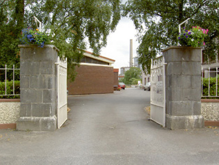 gates/railings/walls119 ydCommons North WalkVisitor information · 442 ydWild birdsVisitor information · 983 ydBallyclare IslandIslet · 1579 ydWhite Sand WoodWood · 1.2 miIndicatedFairy fort / earthen ringfort · 1.2 miIndicatedCrannog · 1.5 mi
 Rathcline CastleHouse, fortified house · 1.6 mi
 Rathcline CastleBawn · 1.6 miFerrinchIslet · 3.0 mi
 Slieve BawnMountain / peak · 4.5 mi
More historic places in County Longford · All of County Longford
What do you know about this place?