What is recorded here
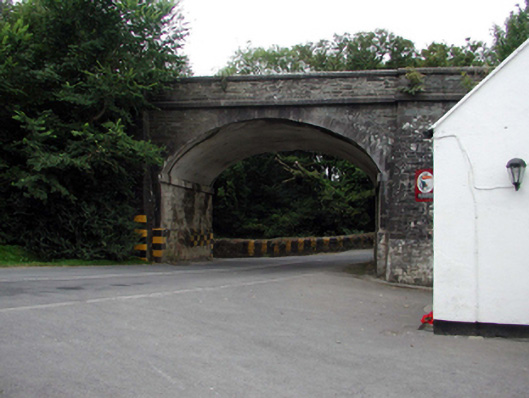
Single-arch bridge over road, built 1862-3. Coursed rubble limestone walls between coursed rubble limestone battered piers with margined tooled cut-limestone chamfered stringcourses supporting parapets having margined tooled cut-limestone coping. Single elliptical arch with margined tooled limestone ashlar crow stepped voussoirs centred on margined tooled cut-limestone keystones. Sited spanning road.
A bridge representing an integral component of the mid nineteenth-century civil engineering heritage of County Waterford with the architectural value of the composition, one allegedly erected in connection with an ill-fated attempt to open a railway line between County Waterford and County Wexford via Passage East and Ballyhack, confirmed not only by the sheer blue-grey limestone dressings demonstrating good quality workmanship, but also by the elegant "sweep" of the arch making a pleasing visual statement in a sylvan street scene: meanwhile, a discreet benchmark remains of additional interest for the connections with cartography and the preparation of maps by the Ordnance Survey (established 1824). NOTE: A pair of borough boundary plates supplied (1980) by Waterford Ironfounders (established 1901) carry the names of Alderman Stephen Rogers (----), Michael Doody (----) and P.H. Flood (----), City Engineer, and recall an earlier borough boundary plate (1896) at Gibbethill (see 22828035).
From the Buildings of Ireland (National Inventory of Architectural Heritage) record 22901815
This does not grant access. Most recorded buildings are privately owned; view them only from public ground unless the owner allows entry.
Places near here
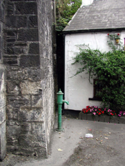 water pump10 yd
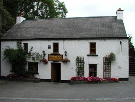 John MeadeHouse · 16 yd
.jpg/250px-Waterford_Castle_-_panoramio_(6).jpg "Photo: Marcin Drozd, Wikimedia Commons · CC BY-SA 3.0") Waterford CastleCastle · 1.6 mi
Waterford CastleCastle · 1.6 mi Monterey Cypress2.2 mi
 Corluddy Castle (in Ruins)Castle, tower house · 7.6 mi
 Gaulstown Portal TombArchaeological place · 7.7 mi
 DolmenPortal tomb · 7.7 miMonterey Cypress7.9 mi
 Grange BeachBeach / strand · 9.1 mi
 Baginbun BeachBeach / strand · 9.5 mi
 Baginbun HeadHeadland · 9.7 mi
 Lime KilnVisitor information · 12 mi
Pictures: National Inventory of Architectural Heritage; Marcin Drozd, Wikimedia Commons · CC BY-SA 3.0; Vadim Manuylov, Wikimedia Commons · CC BY-SA 3.0; Blimey74, Wikimedia Commons · CC0; RTG, Wikimedia Commons · CC BY-SA 4.0; Paul O'Farrell, Geograph · CC BY-SA 2.0; Oliver Dixon, Geograph · CC BY-SA 2.0; Andreas F. Borchert, Wikimedia Commons · CC BY-SA 4.0; Philip Halling, Geograph · CC BY-SA 2.0
More historic places in County Waterford · All of County Waterford
What do you know about this place?