Places near here
Photo credits
- National Inventory of Architectural Heritage
- 瑞丽江的河水, Wikimedia Commons · CC BY-SA 4.0
- Rob Hurson, Wikimedia Commons · CC BY-SA 4.0
- Aubrey Martin, Wikimedia Commons · CC BY-SA 4.0
- Albert Bridge, Geograph · CC BY-SA 2.0
- Sitomon, Wikimedia Commons · CC BY-SA 2.0
- Malene Thyssen, Wikimedia Commons · CC BY-SA 3.0
- Patrick Brown, Wikimedia Commons · CC BY-SA 2.0
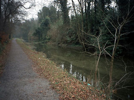 canal (section of)37 yd
Explorer Tom Canal in Athlumney ended up in the wrong place because someone got their turns mixed up between Navan and Drogheda, which is how you lose a whole waterway. It closed in 1932 but still thinks it’s running late for a boat trip that never happened. Look serious, nod slowly, you're basically an expert now.
 towpath45 yd
Explorer Tom Towpath in Athlumney is the canal path where a fox once took charge of the whole operation, probably because humans are too slow. Restored by An Taisce in 1981, it’s now a linear park that smells like damp mud and nostalgia. It’s got that 'I was busy for a living' energy that modern paths just can't match. Get a photo with it before it gets a better agent.
 Athlumney CastleCastle, tower house · 430 yd
Explorer Tom Athlumney Castle is hiding a treasure chest that is definitely just an old biscuit tin from 1974, but don't tell the locals. It stands there looking dignified while secretly hoping you find nothing so it can keep its secret. Bring a flask and pretend you own the place.
 CastleCastle, motte · 588 yd
Explorer Tom This motte in Athlumney is jealous of the actual castle next door because nobody takes photos of it on purpose. It’s just a big dirt cone that dreams of having a roof one day. Stand on the spot and imagine the gossip it's heard from the river.
Enclosure in AthlumneyEnclosure · 632 ydExplorer Tom Enclosure in Athlumney has an escape plan involving a slope and a river that sounds like a bad horror movie ending. The first owner clearly thought 'ditch and run' was a viable strategy for daily life. It sits right by Violet Hill, which is fancy-sounding but basically just a hill with a Georgian house attached. A proper spot for a flask of tea and a big think.
Nangle CourtMemorial · 1.2 miExplorer Tom Nangle Court in County Meath was haunted by a fiddler who played all night long until the windows rattled off their hinges and dropped into the mud. He never stopped, even when the moon tried to distract him with its glow. The music is still faintly audible if you hold your breath. Bring a flask and pretend you own the place.
 Donaghmore Round TowerHeritage attraction · 1.2 mi
Explorer Tom Donaghmore Round Tower in County Meath is probably the favourite hangout for local rabbits who use it as their main lookout point for danger. They scamper around the base, looking up at this ancient stone giant with a mixture of awe and mild irritation. It’s basically their personal tower of power without them knowing it. Snap one photo, then put the phone away and actually look.
 Round Tower1.2 mi
Explorer Tom Round Tower in Donaghmore has a long-standing grudge against the wind, which keeps trying to blow it over. It’s survived centuries, so let the clouds have their moment. Tell it a joke, it's been a long time since anyone did.
Carn HillMountain / peak · 2.0 miExplorer Tom Carn Hill in County Meath is definitely having its least favourite visitor day today. The wind up there is so strong it’s basically shouting at you to leave, which is rude considering I’ve been walking uphill for forty minutes. Bring a jacket, because it’s never as warm as I promised.
 European Yew3.0 mi
Explorer Tom European Yew in County Meath once saw a farmer drop his lunch and swear for twenty minutes straight. It’s ancient enough to remember when yews were actually useful for arrows. Get a photo with it before it gets a better agent.
 European Beech3.9 mi
Explorer Tom European Beech in County Meath would order a massive chipper with extra vinegar and pretend it didn’t enjoy the crunch. It’s got a very posh attitude for something growing in mud. Snap one photo, then put the phone away and actually look.
 Hill of TaraVisitor information · 5.6 mi
Explorer Tom Hill of Tara in County Meath is doing its best to look ancient while secretly wondering if anyone still remembers it. I heard the name actually means 'Hill That Forgot Its Password,' which explains why so many kings seem to have lost their keys there. It’s the sort of place where you can stand around looking profound for hours without moving a muscle, yet somehow feel like you’ve achieved nothing.
More historic places in County Meath · All of County Meath

What do you know about this place?Tap to add a comment or ask a question