
What is recorded here
Single-arch hump back road bridge over stream, extant 1840. Part repointed coursed rubble limestone walls with rendered rounded coping to parapets. Single elliptical arch with rough hewn rubble limestone voussoirs. Sited spanning stream.
A bridge representing an integral component of the civil engineering heritage of south County Wexford.
From the Buildings of Ireland (National Inventory of Architectural Heritage) record 15704849
This does not grant access. Most recorded buildings are privately owned; view them only from public ground unless the owner allows entry.
Places near here
Photo credits
- National Inventory of Architectural Heritage
- User Ali-oops on en.wikipedia, Wikimedia Commons · GFDL
- Ojsyork, Wikimedia Commons · CC BY 4.0
- DeFacto, Wikimedia Commons · CC BY-SA 4.0
- Andrewmc, Wikimedia Commons · Public domain
Bullocks TrackRitual site, holy/saint's stone · 73 ydIndicatedBawn · 874 yd mill (wind)1266 ydThe Fairy Stone/RockNamed rock · 1385 ydBallycronigan HouseCountry house · 1423 ydRosslare Harbour Maritime Heritage CentreMuseum · 1.4 miMoran's Bay PostVisitor information · 1.4 miCastleCastle, tower house · 1.7 miCarne BeachBeach / strand · 2.3 miLifeboat MemorialMemorial · 2.4 miWindmill (Corn) (Disused)Windmill · 4.4 miTuskar RockIsland · 5.3 mi
 mill (wind)1266 ydThe Fairy Stone/RockNamed rock · 1385 yd
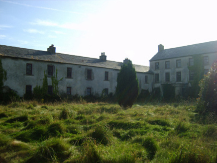 Ballycronigan HouseCountry house · 1423 ydRosslare Harbour Maritime Heritage CentreMuseum · 1.4 miMoran's Bay PostVisitor information · 1.4 miCastleCastle, tower house · 1.7 mi
 Carne BeachBeach / strand · 2.3 mi
 Lifeboat MemorialMemorial · 2.4 mi
 Windmill (Corn) (Disused)Windmill · 4.4 mi
 Tuskar RockIsland · 5.3 mi
More historic places in County Wexford · All of County Wexford
What do you know about this place?