What is recorded here
Located on a level landscape with a small N-S stream c. 130m to the W. Kilrothan (Kilrane) was held for a quarter of a knight’s fee by Peter Keteinge in 1425 from the Valence property (Brooks 1950, 188-9). It is not mentioned in earlier feoderies, which suggests it is a late enfeoffment. Keteinge was one of the Keatings of Kilcowanmore (WX031-009----) and Slieve Coillte, but by the 16th century Staffords dominated Kilrane (Jeffrey 1979, 4-5). The tower house pre-dated the fortified house (WX048-033003-), which was built in 1570 by Dionisius Stafford and his second wife Katherine Synnott of Ballygerry (WX048-017----), according to the Latin inscription of a memorial stone now lost. His first wife was Joan Browne of Mulrankin (WX047-031----) (Hore 1925, 15-6; Browne 1937). In 1641 John Stafford owned 166 acres at Ballyconor and 186 acres in Kilrane parish at Harristown and Hilltown (Simmington 1953, 306). The rectangular tower house (ext. dims 7.1m E-W; 6.95m N-S) survives to the second floor (H 6-8 m) with a base-batter and good quoins. All the dressed stone is granite. The pointed entrance doorway (Wth 0.92m; H 1.61) towards the W end of the N side is protected by a portcullis, and gives access through a lobby lacking a murder-hole to the ground floor chamber (int. dims 5m E-W; 3.55m N-S). The entrance from the lobby is destroyed but the ground floor has central embrasures on the E, S and W walls. In addition there is a chamber with a loop on the E wall at the NE angle and another with a loop in the S wall at the SE angle. Each embrasure has two long lateral spy-holes that emerge on the outer face of the walls. The ceiling was supported on two corbels in the N and S walls. A destroyed doorway from the lobby leads to the mural stairs in the N wall, which has two loops in its outer wall and a light at the E end, on the landing outside the lintelled doorway (Wth 0.84m; H 1.54m) to the first floor under the E-W vault. This floor has embrasures with rectangular windows in the E (Wth 0.17m; H 0.72m) and W (Wth 0.16m; H 0.82m) walls. There are two cupboards in the S wall and another at the S end of the W wall. An ante-chamber at the NW angle controlled the portcullis and has a rectangular window (Wth 0.45m; H 0.54m), modified with brick, in the W wall. From the landing outside the first floor doorway the stairs becomes a newel stairs and rises to the second floor over the vault and higher floors but the walls were reduced to this level. The doorway to the second floor is destroyed, but a large opening (Wth 1.09m; H 1.88m) with some dressed stone on the E wall may have led from the stairs to an attached building, which is entirely gone. The second floor has a window in the W wall, a window at the SW angle and one or more loops at the SE angle. There is a blocked window in the E wall and there may have been more loops at the NW angle. The 16th century house (WX048-033003-) is attached to the N of the tower house, but only the W wall and N gable survive. The church of St Nicholas (WX048-033002-) is on N side of a possible bawn (WX048-033005-) (int. dims 34m E-W; 24m N-S) defined on the E side by the tower house and the 16th century house, at N by the church, and at W by the remains of stone wall (H 1m) that has a blocked embrasure.
Located on a level landscape with a small N-S stream c. 130m to the W. Kilrothan (Kilrane) was held for a quarter of a knight’s fee by Peter Keteinge in 1425 from the Valence property (Brooks 1950, 188-9). It is not mentioned in earlier feoderies, which suggests it is a late enfeoffment. Keteinge was one of the Keatings of Kilcowanmore (WX031-009----) and Slieve Coillte, but by the 16th century Staffords…
From the National Monuments Service (Archaeological Survey of Ireland) record WX048-033001
The monument record does not grant public access. Check the route and ask the landowner before entering private land.
- What survives
- Recorded monument
Places near here
Photo credits
- National Inventory of Architectural Heritage
- User Ali-oops on en.wikipedia, Wikimedia Commons · GFDL
- Ojsyork, Wikimedia Commons · CC BY 4.0
- DeFacto, Wikimedia Commons · CC BY-SA 4.0
- Cozzmick, Wikimedia Commons · CC BY-SA 4.0
Church (Site of)Church · 855 yd Saint Ruane's Catholic ChurchChurch/chapel · 864 ydpost box959 ydRosslare Harbour Maritime Heritage CentreMuseum · 1391 ydIndicatedBawn · 1.4 miMoran's Bay PostVisitor information · 1.6 miThe Fairy Stone/RockNamed rock · 1.7 miLady's IslandVisitor information · 1.9 miCarne BeachBeach / strand · 2.6 miLifeboat MemorialMemorial · 2.8 miWindmill (Corn) (Disused)Windmill · 3.2 miCastleCastle, tower house · 4.1 mi
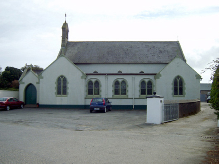 Saint Ruane's Catholic ChurchChurch/chapel · 864 yd
 post box959 ydRosslare Harbour Maritime Heritage CentreMuseum · 1391 ydIndicatedBawn · 1.4 miMoran's Bay PostVisitor information · 1.6 miThe Fairy Stone/RockNamed rock · 1.7 miLady's IslandVisitor information · 1.9 mi
 Carne BeachBeach / strand · 2.6 mi
 Lifeboat MemorialMemorial · 2.8 mi
 Windmill (Corn) (Disused)Windmill · 3.2 mi
 CastleCastle, tower house · 4.1 mi
More castles and forts in County Wexford · All of County Wexford
What do you know about this place?