
What is recorded here
Borthwick Castle, Gateway is a gateway in Midlothian, Scotland.
From the Historic Environment Scotland record 245672
The historic-place record does not grant public access. Check current conditions and ownership before entering land or a building.
Places near here
Photo credits
- Godot13, Wikimedia Commons · CC BY-SA 4.0
- Maigheach-gheal, Wikimedia Commons · CC BY-SA 2.0
- stephen samson, Wikimedia Commons · CC BY-SA 2.0
- Richard Webb, Wikimedia Commons · CC BY-SA 2.0
- M J Richardson, Wikimedia Commons · CC BY-SA 2.0
- James Denham, Wikimedia Commons · CC BY-SA 2.0
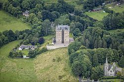 Borthwick Castle HotelCastle · 26 yd
 Borthwick CastleCross (medieval) (possible) · 32 yd
 Borthwick ChurchCross(s) (8th Century) - (10th Century), Font (15th Century) · 32 yd
 Borthwick CastleTower House (medieval) · 32 yd
 Currie BridgeBridge · 144 yd
 Borthwick ChurchChurch (12th Century) - (18th Century), Church (18th Century), Sundial (18th Century) (1705), Tomb (medieval), War Memorial (20th Century) · 147 yd
 Currie WoodWood · 161 yd
 War MemorialMemorial · 165 yd
 Currie WoodWood · 641 yd
 Gorebridge, Harvieston CemeteryCemetery (20th Century) · 1.5 mi
 Halk LawMountain / peak · 2.0 mi
 Ruther LawMountain / peak · 2.6 mi
More historic places in Midlothian · All of Midlothian
What do you know about this place?