DDiscover AloneMapAbout

Bolus Signal Tower

Barracks
Computer-made picture that does not show Bolus Signal TowerNot a photo of this monument
Computer-made picture. It does not show this monument. · Report the wrong picture

The monument record does not grant public access. Check the route and ask the landowner before entering private land.

What do you know about this place?Tap to add a comment or ask a question

What you write will be public.

What is recorded here

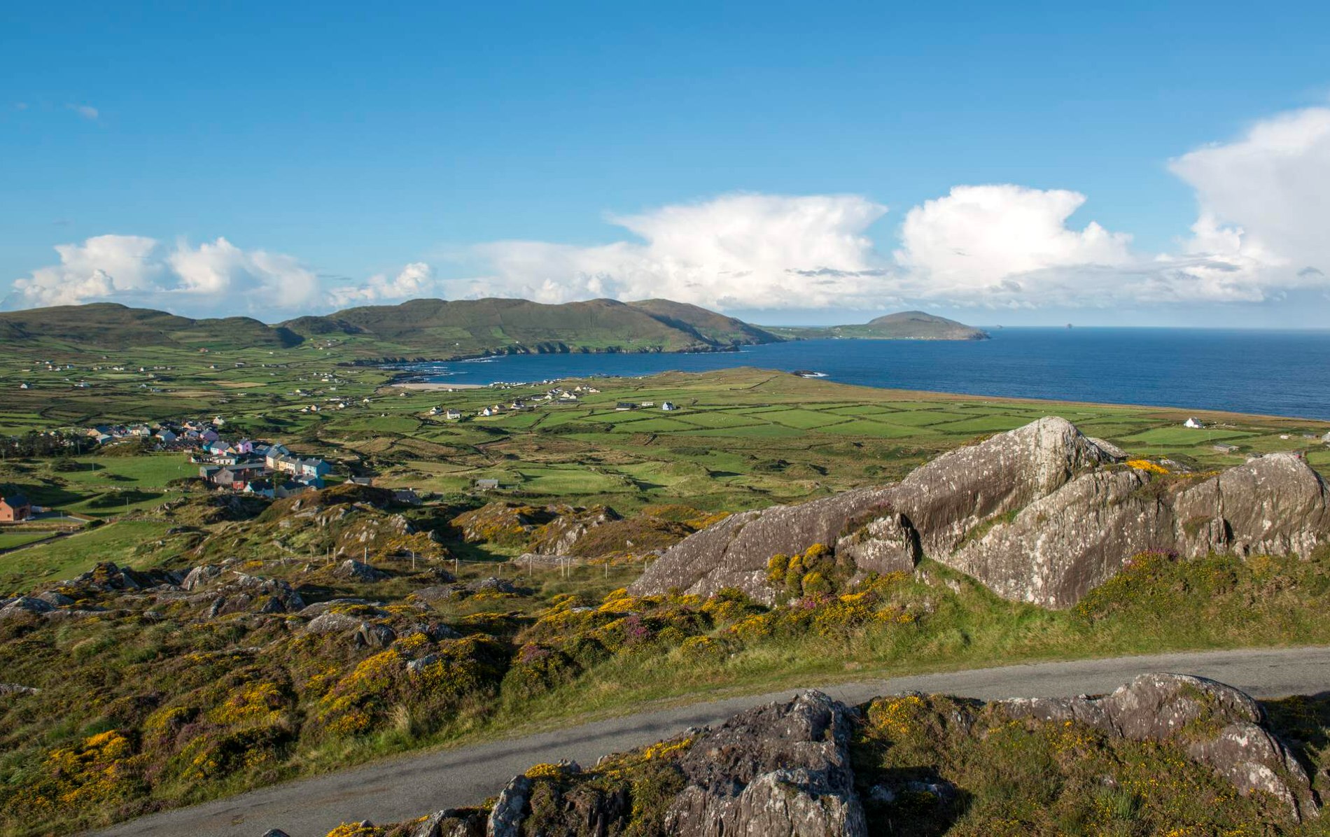
Situated at the NE end (and at high point\crest) of a NE-SW running ridge that extends out to Bolus Head c. 1.1kms to the SW (OD c. 285m). Located on the wide flat crest of the ridge with downward slopes to the coastline to the N, W, and S; extensive views over Ballinskelligs Bay to the S and SE and over St. Finian's…

Read the whole record
Situated at the NE end (and at high point\crest) of a NE-SW running ridge that extends out to Bolus Head c. 1.1kms to the SW (OD c. 285m). Located on the wide flat crest of the ridge with downward slopes to the coastline to the N, W, and S; extensive views over Ballinskelligs Bay to the S and SE and over St. Finian's Bay to the N and NW. Located c. 580m E of coastline at closest point close to sea cliffs at Bolus Point. The surrounding area consists of unenclosed rough pasture with an area of enclosed pasture (defined by mainly linear irregular rubble stone boundary walls, now mostly collapsing) located further down the slope to the E and SE after c. 300m. Site located c. 570m ESE of the associated signal station at Bolus Point (KE096-024----). The ‘enclosed barrack signal station’ site at Bolus is located c. 1.8kms W\WSW of an ecclesiastical enclosure (KE097-044001-) containing the remains of a church (KE097-044002-) with multiple associated sites located at Cill Rialaigh, and c. 2.6kms S of a coastal promontory fort (KE096-014----), known as ‘Doongar’ located on a narrow promontory between St. Finan’s Bay and Ducalla Head at Alachaí Mór. The remains of an early nineteenth-century (c. 1810) three-bay two-storey or single-storey over raised basement rectangular-plan (ext. dims c. 10.5m NW-SE x c. 4.3m NE-SW; wall T c. 0.75m) former enclosed barracks\signal station associated with the signal station\tower network. Possibly\probably originally with a signal mast to site. Constructed of random rubble sandstone with some flush roughly-dressed sandstone quoins to the corners. Now roofless and collapsing. Gable-ended (NW and SE) and formerly with tall rubble stone chimneystacks rising over gable ends (NW and SE), now collapsed (totally collapsed to SE gable). Each chimneystack originally served two fireplaces on the ground floor level and one fireplace on the first floor level. Mono-pitched roof (collapsed) with roof originally sloping from rear elevation (NE; wall H c. 9m) to front elevation (SW; wall H c. 7m). Square-headed doorway to the centre of the front elevation (SW) at first floor level; doorway now partially collapsed. Doorway original reached up flight of freestanding rubble stone ramp\steps (L SW-NE c. 5.4m) with a gap (L c. 2.2m SW-NE) that formerly gave access to doorway via a timber gangway\drawbridge, now gone. Formerly square-headed window openings flank central doorway at first floor level (collapsed) to SW elevation with corresponding square-headed window openings below at ground floor level (to NW and SE ends of entrance elevation to SW). Square-headed window opening to the SE end of the rear elevation (NE) at first floor level. Single-bay one-and-a-half storey rubble stone annexes (ext. dims c. 2.8m NW-SE x c. 1.85m NE-SW) are attached to either gable end of main structure (NW and SE) formerly with mono-pitched roofs (now collapsed) that sloped downwards from gable walls of main structure; annexe now partially collapsed. The barracks form the enclosing element to the centre of the NE side of a rectangular-plan enclosure (ext. dims c. 26.5m NE-SW; x c. 24m NW-SE) that is defined elsewhere by well-constructed rubble stone boundary walls (wall T c. 0.6m; max H c. 2.5m). Boundary wall to the NW side of enclosure now collapsed\removed to centre (gap c. 4-5m NE-SW). Square-plan bastions project outwards from the boundary walls to each corner of the enclosure (N, S, E, and W) each originally with two splayed gun vertical gun loops to provide enfilading fire along each wall; bastions now largely collapsed (bastion to S now totally collapsed). A well-preserved World War II-era Lookout Post (LOP 34) is located c. 32m to the W of the enclosed barrack site. The site is one of four Enclosed Barracks of extremely similar form that were constructed around the coast of County Kerry (Kerrigan 1995, 162-3). Although some uncertainty remains about the age of the sites, all four of the enclosed barracks were likely constructed between 1808 and 1812. The sites seem to have been specifically related to the system of signal stations\towers constructed around the Irish coast between 1804 and 1806, added in areas where intervisibility between signal towers had proved difficult. However, this example at Bolus Head is located close to the site of a signal tower (KE096-024----; located c. 560m to the WNW). It is not clear if these larger and more complex additions to the system were designed to house larger signal crews, or if they were designed to house the same size signal crews in more comfort than was to be found at the unpopular signal towers. The Enclosed Barracks were presumably abandoned by 1815, when the signal towers around the SW coast were decommissioned.

From the National Monuments Service (Archaeological Survey of Ireland) record KE104-001

Places near here

Photo credits
  • Michael Earnshaw, Geograph · CC BY-SA 2.0
  • Martin Creek, Wikimedia Commons · CC BY-SA 2.0
  • Maker not stated on source page, sacredsites.com
  • Maker not stated on source page, www.ireland.com
  • Maker not stated on source page, www.pinterest.com
  • Maker not stated on source page, visionsofthepastblog.com
  • Maker not stated on source page, www.isle-of-mull.net
  • Maker not stated on source page, www.flickr.com
  • Adam Ward, Wikimedia Commons · CC BY-SA 2.0
  • Jibi44, Wikimedia Commons · CC BY 2.5
  • Maker not stated on source page, focusedcollection.com
Bolus PointHeadland · 895 yd

Explorer Tom Bolus Point is a headland where locals swear if you wink at the Skelligs in the distance, they’ll wink back, though…

Ceann BhólaisHeadland · 1204 yd

Explorer Tom Ceann Bhólais is looking down its nose at tourists from Dublin, thinking they’re all just here to find the best pint in…

Holy well in Cill RialaighHoly well · 1.1 mi

Explorer Tom Holy well in Cill Rialaigh would tell the cliff next door to stop showing off so much. It’s just a pool with some…
Oileán Chuas a' BháidIslet · 4.3 mi

Explorer Tom Oileán Chuas a' Bháid has been hiding a scandal involving a smuggler who lost his hat in the tide in 1842 and never got…

Bulligacrowig RockIslet · 4.6 mi

Explorer Tom Bulligacrowig Rock has a hidden message carved into its stones that says 'I’m still here', which I think is honestly…

Cross-inscribed stone in CoomanaspigCross-inscribed stone · 5.0 mi

Explorer Tom Cross-inscribed stone in Coomanaspig was moved from a hermit’s garden to a graveyard because people liked the view…

Standing stone in CoomanaspigStanding stone · 5.2 mi

Explorer Tom Standing stone in Coomanaspig is stuck in bog but acting like it owns the place. It’s not on any map, which makes it…

Bray Head Signal TowerRuins · 7.5 mi

Explorer Tom Bray Head Signal Tower is stuck in a feud with the family next door over who actually owns the best view of the…

Boilg na ManachIslet · 8.8 mi

Explorer Tom Boilg na Manach has an imaginary twin across the sea that it argues with every night, shouting about who gets to keep…

Sceilig MhichílIslet · 8.8 mi

Explorer Tom You want a quiet island stroll? The Atlantic has other paperwork. Sceilig Mhichíl looks like somebody dropped two…

Skelligs LighthouseLighthouse · 8.9 mi

Explorer Tom Skelligs Lighthouse stands there looking mighty impressive, though the local sheep seem to think it's just a very tall…

Graveyard in Inis Mhic AoibhleáinGraveyard · 21 mi

Explorer Tom Graveyard in Inis Mhic Aoibhleáin has a New Year's resolution to stop getting blown away by the Atlantic wind. It’s on…

More archaeology and monuments in County Kerry · All of County Kerry

Add to this placeAdd a picture Add a detailed tip Add a story

Explore the map1,095,414 places to discover

Next place · or swipeBolus Point