What is recorded here
From OpenStreetMap (© OpenStreetMap contributors) n6593662487
Places near here
Photo credits
- Newbert12, Wikimedia Commons · CC BY-SA 4.0
- Britishfinance, Wikimedia Commons · CC BY-SA 4.0
- Nigel Thompson, Geograph · CC BY-SA 2.0
- National Inventory of Architectural Heritage
- Joseph Mischyshyn, Wikimedia Commons · CC BY-SA 2.0
- Didier Descouens, Wikimedia Commons · CC BY-SA 4.0
- Maker named on the Wikimedia Commons picture page · Public domain
- dconvertini, Wikimedia Commons · CC BY-SA 4.0
- Patrice78500, Wikimedia Commons · Public domain
- Dr. Charles Nelson, Wikimedia Commons · CC BY-SA 2.0
 Ballynahinch Church (Moyrus)Church/chapel · 1360 yd
Explorer Tom Ballynahinch Church (Moyrus) in Emlaghdauroe is sitting in a landscape that looks like it was made by a grumpy god. The church itself is very fancy for its size, probably trying too hard to impress the passing clouds. If it’s closed, admire it from the bog.
 BengleniskyMountain / peak · 1.1 mi
 CrannogIslet · 1.2 mi
 Ballynahinch CastleFarmyard complex · 1.4 mi
 Fairy fort / stone ringfort in BallynahinchFairy fort / stone ringfort · 1.4 mi
Explorer Tom Ballynahinch’s stone fort is sitting in a lake on an island that might be artificial. It’s basically a boulder pile with delusions of grandeur and zero privacy. Pretend it's yours and plan the housewarming.
 Binn LeitríMountain / peak · 1.7 miSt. Fechins Holy WellHoly well · 1.9 mi
Explorer Tom St. Fechins Holy Well in Killeen is playing hard to get near Ballynahinch Lake. A spring with a drystone circle that O'Flaherty spotted back in 1684, basically. Bring curiosity and leave with a better story than my failed fishing trip.
 Hawthorn3.4 mi
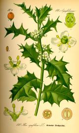 English holly3.4 mi
 Pine IslandIslet · 3.9 mi
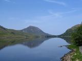 Binn GhuaireMountain / peak · 4.6 mi
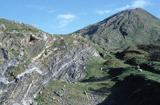 Connemara National ParkNational park · 5.2 mi
More viewpoints and information in County Galway · All of County Galway

What do you know about this place?Tap to add a comment or ask a question