Places near here
Photo credits
- Eoghan OLionnain, Wikimedia Commons · CC BY-SA 2.0
- Eric Jones, Geograph · CC BY-SA 2.0
- National Inventory of Architectural Heritage
- Eric Jones, Geograph · Creative Commons Attribution-ShareAlike 2.0
- DarranRaff, Wikimedia Commons · CC BY-SA 4.0
- Digital Eye, Wikimedia Commons · CC BY-SA 4.0
- JalvinWiki, Wikimedia Commons · CC0
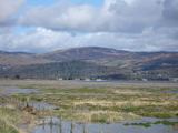 Cooley MountainsMountain range · 1245 yd
Explorer Tom The Cooley Mountains are currently being run by a very aggressive terrier named Bob who thinks he owns every single…
 Long Woman's GraveArchaeological place · 1.1 mi
Explorer Tom Long Woman's Grave sounds like a stretchy yoga instructor who got stuck underground, but it’s really just a very…
 CarnavaddyMountain / peak · 1.1 mi
Explorer Tom Carnavaddy has a secret talent for looking exactly like a prehistoric cairn, which keeps hikers confused about whether…
 The Round MountainMountain / peak · 1.1 mi
Explorer Tom The Round Mountain has an unlikely celebrity friend who visits every year to hide from their ex. It’s basically the…
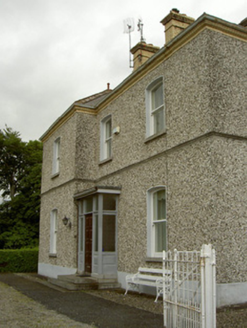 presbytery/parochial/curate's house1.7 mi
Explorer Tom Presbytery in Doolargy is stuck in a feud with the house next door over who gets the best view of the church, and it’s…
 Saint Mary's Roman Catholic ChurchChurch/chapel · 1.7 mi
Explorer Tom Saint Mary's Church in Doolargy is haunted by a fiddler who never stopped playing. He’s been going since 1830 and…
 Giants GraveWedge tomb · 2.5 mi
Explorer Tom Giants Grave in Proleek is basically run by a dog who thinks he owns the place. The wedge tomb is gone now, but the…
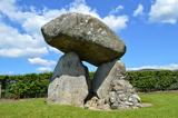 Proleek DolmenArchaeological place · 2.5 mi
Explorer Tom Proleek Dolmen balances a mighty stone in a way that makes me suspicious of my own wobbly garden wall. The portal tomb…
 DolmenPortal tomb · 2.5 mi
Explorer Tom Dolmen in Proleek has a ghost that’s too lazy to haunt it properly. The roof stone is massive and looks like it fell…
 Ravensdale ForestForest · 3.1 mi
Explorer Tom Ravensdale Forest climbs steeply above County Louth, with enough paths to make an easy plan turn into a proper woodland…
 Ravensdale LoopWalking route · 3.2 mi
Explorer Tom Ravensdale Loop features a cairn that looks like it's judging your life choices. The local sheep have formed a union…
 Carlingford - Slieve Foye LoopWalking route · 3.6 mi
Explorer Tom Carlingford - Slieve Foye Loop in County Louth bragged about surviving a storm that flattened three hedges and one…
More viewpoints and information in County Louth · All of County Louth

What do you know about this place?Tap to add a comment or ask a question