
What is recorded here
Recorded construction date: 1720 - 1739. Current recorded use: Bridge.
From the Northern Ireland Historic Buildings Record record HB16/01/001
The official record and map point do not grant access. Many historic buildings are privately owned; view them only from public ground unless the owner allows entry.
Places near here
Photo credits
- Eric Jones, Wikimedia Commons · CC BY-SA 2.0
- Eric Jones, Geograph · CC BY-SA 2.0
- Bob Jones, Geograph · Creative Commons Attribution-ShareAlike 2.0
- Ross, Wikimedia Commons · CC BY-SA 2.0
- N Chadwick, Geograph · CC BY-SA 2.0
- HENRY CLARK, Geograph · CC BY-SA 2.0
 Bloody Bridge (new)Bridge · 64 yd
 Church (in ruins); graveyard and enclosure: st.mary's or ballachanery or bloody bridge in Ballaghanery UpperChurch (in ruins) · 286 yd
 LeganabruchanMountain / peak · 1.1 mi
 CrossoneMountain / peak · 1.3 mi
 Drinneevar LoopWalking route · 1.4 mi
 The Bogie LineWalking route · 1.7 mi
 Harbour: newcastle harbour in BallaghbegHarbour: Newcastle Harbour · 1.7 mi
 Multiple cist cairn: lesser carn in Ballaghbeg; Ballyaghanery UpperMultiple Cist Cairn: Lesser Carn · 1.8 mi
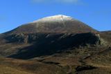 Slieve DonardMountain / peak · 1.9 mi
 SS Great BritainVisitor information · 1.9 mi
 Black StairsWaterfall · 2.0 mi
 Donard ForestForest · 2.0 mi
More historic places in County Down · All of County Down
What do you know about this place?