Places near here
Photo credits
- Bob Embleton, Wikimedia Commons · CC BY-SA 2.0
- Andy Farrington, Wikimedia Commons · CC BY-SA 2.0
- Billy McCrorie, Wikimedia Commons · CC BY-SA 2.0
- Neil Theasby, Wikimedia Commons · CC BY-SA 2.0
- Ann Cook, Wikimedia Commons · CC BY-SA 2.0
- James Johnstone, Wikimedia Commons · CC BY-SA 2.0
 'the Wren's Egg'Standing Stone(s) (prehistoric) · 129 yd
Explorer Tom 'the Wren's Egg' is a standing stone named after a bird that probably fell into the ditch nearby and got confused about…
 BlairbuyWatermill · 216 yd
Explorer Tom Blairbuy is a watermill that’s been listening to the river gossip since forever, which must be exhausting if you’re…
 Blairbuy FarmhouseFarmstead · 221 yd
Explorer Tom Blairbuy Farmhouse in Glasserton parish has a farmstead on the historic record, and my imaginary auctioneer is trying…
 Monreith House, Bridge LodgeLodge · 430 yd
Explorer Tom Monreith House Bridge Lodge in Dumfries and Galloway has a very strong opinion about the road that leads directly to…
 Burnside CottageCottage · 479 yd
Explorer Tom Burnside Cottage would teach history by shouting over the noise of the burn, which never stops talking. It’d start a…
 Fell of BarhullionArmlet, Flanged Axehead, Spearhead · 855 yd
Explorer Tom Fell of Barhullion in Dumfries and Galloway is hiding an armlet, an axehead, and a spearhead, which is basically a…
 South BarsallochFarmhouse, Farmstead · 917 yd
Explorer Tom South Barsalloch has a farmhouse and farmstead in Mochrum parish, and my imaginary compass insists every fence should…
 StellockAxe Hammer(s) · 1009 yd
Explorer Tom Stellock in Dumfries and Galloway has axe hammers that are convinced they have an imaginary twin across the sea who is…
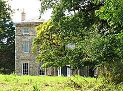 Monreith HouseCountry House (18th Century) · 1155 yd
Explorer Tom Monreith House sounds like 'Money Teeth' if you squint hard enough at the map, which is exactly what I’m doing right…
 Myrton CastleCastle (medieval), Motte (medieval) · 1388 yd
Explorer Tom Myrton Castle in Dumfries and Galloway is sitting on a motte that looks like someone dumped a hill of dirt and said…
 Camlough: Monreith Bay, Luce Bay, Solway FirthSteamship (20th Century) · 1543 yd
 Court Hill PlantationForest · 1705 yd
More historic places in Dumfries and Galloway · All of Dumfries and Galloway

What do you know about this place?Tap to add a comment or ask a question