
Places near here
Photo credits
- Andy Farrington, Wikimedia Commons · CC BY-SA 2.0
- David Medcalf, Wikimedia Commons · CC BY-SA 2.0
- Ann Cook, Wikimedia Commons · CC BY-SA 2.0
- Jon Alexander, Wikimedia Commons · CC BY-SA 2.0
- Les Dunford, Wikimedia Commons · CC BY-SA 2.0
- Leslie Barrie, Wikimedia Commons · CC BY-SA 2.0
- Bob Embleton, Wikimedia Commons · CC BY-SA 2.0
 White Loch of MyrtonCrannog · 181 yd
Explorer Tom White Loch of Myrton has a crannog, which is basically an island house for people who hate neighbours. If it had to…
 Monreith MainsFarmstead · 260 yd
Explorer Tom Monreith Mains is just a farmstead with no assigned period, which means it’s basically been around forever and refuses…
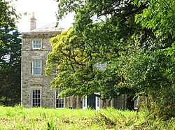 Monreith HouseCountry House (18th Century) · 655 yd
Explorer Tom Monreith House sounds like 'Money Teeth' if you squint hard enough at the map, which is exactly what I’m doing right…
 Monreith House, Lochend LodgeLodge · 743 yd
Explorer Tom Lochend Lodge got its position wrong because the map maker was drunk on a Tuesday afternoon. He put it three meters off…
 Monreith House, North LodgeLodge · 823 yd
Explorer Tom Monreith North Lodge is called Monreith, which sounds like 'money right' if you squint hard enough. I’m sure that’s…
 Cupid Hill CottageCottage · 1036 yd
Explorer Tom Cupid Hill Cottage would do brilliantly on a reality show, mostly because the name is too good to ignore. The cameras…
 DrumfadAxe Hammer(s) · 1074 yd
Explorer Tom Drumfad in Dumfries and Galloway has axe hammers that are constantly jealous of the famous swords getting all the…
 Monreith, West Gate LodgeGate Lodge (19th Century) · 1182 yd
Explorer Tom Monreith West Gate Lodge is standing guard at the entrance, probably because two lads made a bet in the pub that if…
 DrumtroddanStanding Stone(s) (prehistoric) · 1214 yd
Explorer Tom Drumtroddan is a standing stone that map makers got wrong because they were looking at it upside down in a mirror held…
 Drumtroddan Standing StonesArchaeological place · 1217 yd
Explorer Tom Drumtroddan Standing Stones had a matchmaker working there who paired up everyone with someone taller, which explains…
 'the Wren's Egg'Standing Stone(s) (prehistoric) · 1405 yd
Explorer Tom 'the Wren's Egg' is a standing stone named after a bird that probably fell into the ditch nearby and got confused about…
 Court Hill PlantationForest · 1727 yd
More castles and forts in Dumfries and Galloway · All of Dumfries and Galloway

What do you know about this place?Tap to add a comment or ask a question