Birr is situated in the low-lying fertile valley of the Little Brosna River. The town developed SE of the castle (OF035-012004-) and within the bounds of a pronounced meander in the River Camcor. The Camcor joins the Little Brosna to NW of the town. St Brendan reputedly established a monastery (OF035-012001-/003-) here in the 6th century which subsequently became a prestigious and influential foundation and one of the most celebrated members of St Columcille's great federation of churches. Located in the border area between the provinces of Munster, Meath, Leinster and Connacht and itself located in the territory of Eile in Munster, the monastic settlement was frequently chosen as a venue for the meetings of both kings and churchmen, perhaps the most significant of which were the synods of AD 697 and 1174. An Anglo-Norman castle (OF035-012009-) and settlement had been established at Birr by 1207 and continued at least until c. 1315. By the mid-14th century the settlement had reverted to the O'Carrolls of Ely. The 'Black Castle' became one of the principal seats of the ruling branch of that dynasty and remained as such until its sale to Butler of Ormond in 1594. In 1621 as part of the Plantation of Ely O'Carroll, Laurence Parsons was granted the lands, 'castle and fortilage' of Birr which became the manor of Parsonstown. Present remains at Birr consist of 19th-century castle designed by John Johnson built around the core of a 17th century castle (OF035-012004-), near to the site of a 13th-century O'Carroll castle and a twelfth century Anglo-Norman motte castle (OF035-012009-). Earliest references to a castle located here in the 1207 (Annals of Clonmacnoise) when it was attacked and destroyed by Murchad Ua Briain. Black castle was demolished in 1778 (Girouard 1965) and replaced by lawns and parkland. This castle is illustrated as a rectangular building located on the edge of a steep cliff edge overlooking the Camcor River on the 1691 Richards map of Birr.
Birr is situated in the low-lying fertile valley of the Little Brosna River. The town developed SE of the castle (OF035-012004-) and within the bounds of a pronounced meander in the River Camcor. The Camcor joins the Little Brosna to NW of the town. St Brendan reputedly established a monastery (OF035-012001-/003-) here in the 6th century which subsequently became a prestigious and influential foundation and one…
Pictures: The original uploader was Tpower at English Wikipedia ., Wikimedia Commons · CC BY-SA 3.0; National Inventory of Architectural Heritage; AnRo0002, Wikimedia Commons · CC0; David P Howard, Geograph · CC BY-SA 2.0; Superchilum, Wikimedia Commons · CC BY-SA 4.0; Jonathan Thacker, Geograph · CC BY-SA 2.0; Corcs999, Wikimedia Commons · CC BY-SA 3.0; Mike Searle, Wikimedia Commons · CC BY-SA 2.0; Brian Shaw, Wikimedia Commons · CC BY-SA 2.0; Eric Jones, Geograph · CC BY-SA 2.0

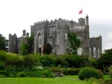 Birr CastleCastle · 1 yd
 Birr CastleCastle/fortified house · 3 yd
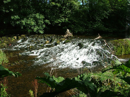 weir83 yd
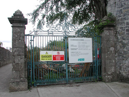 Saint Brendan's ChurchChurch/chapel · 89 yd
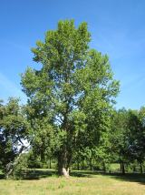 Grey Poplar286 yd
 Emmet SquareMonument · 300 yd
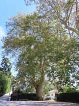 Oriental plane425 yd
 River WalkWalking route · 769 yd
 Cloghan CastleCastle · 6.8 mi
_-_geograph.org.uk_-_4074509.jpg/250px-Castles_of_Leinster,_Cloghan,_Offaly_(2)_-_geograph.org.uk_-_4074509.jpg "Photo: Mike Searle, Wikimedia Commons · CC BY-SA 2.0") Cloghan CastleCastle, tower house · 6.8 mi
Cloghan CastleCastle, tower house · 6.8 mi Banagher TowerMartello tower · 7.6 mi
 Cloghan HillMountain / peak · 8.8 mi
What do you know about this place?