What is recorded here
Map note: In County Derry, Ireland, the map records Binevenagh Forest as a forest. The map knows where the place is, even if the scenery is staying quiet.
Binevenagh Forest is recorded as a forest in County Derry.
From OpenStreetMap (© OpenStreetMap contributors) w100135323
Places near here
Photo credits
- David Trochos at English Wikipedia, Wikimedia Commons · Public domain
- Colin Park, Geograph · CC BY-SA 2.0
- Kenneth Allen, Geograph · CC BY-SA 2.0
- Kenneth Allen, Wikimedia Commons · CC BY-SA 2.0
- Colin Park, Wikimedia Commons · CC BY-SA 2.0
- Rossographer, Geograph · CC BY-SA 2.0
- Carroll Pierce, Geograph · CC BY-SA 2.0
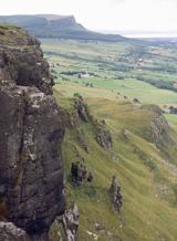 BinevenaghMountain / peak · 1021 yd
 Binevenagh ViewViewpoint · 1496 yd
 Aidan's WellSpring · 1.5 mi
 Ballyhanna ForestForest · 1.5 mi
 Swann's BridgePicnic place · 1.9 mi
 Bellarena SchoolSchool · 2.0 mi
Explorer Tom Bellarena School in Bellerena is where they taught kids how to survive boredom before smartphones existed. The least favourite visitor was definitely the headmaster’s uncle, probably. Look up, the best bit is always higher than you think.
 Aghanloo Church of Ireland ChurchChurch · 2.3 mi
Explorer Tom Aghanloo's Church of Ireland was built in the 1820s and once a cow tried to buy it with a carrot. It's now just a church, but with drama. Stand still and listen, the wind tells it better than me and probably judges you less.
 Manannán mac LirSculpture · 2.5 mi
 North Base Station, Lough Foyle Base LineMonument · 3.1 mi
 Keady MountainMountain / peak · 4.3 mi
 DrenaghCastle · 4.3 mi
 Magilligan - Benone StrandBeach / strand · 4.4 mi
More woods, forests and old trees in County Derry · All of County Derry

What do you know about this place?Tap to add a comment or ask a question