
What is recorded here
Berneray, Sand Hill is a midden in Na h-Eileanan Siar, Scotland.
Places near here
Picture notes
- Colin Smith, Wikimedia Commons · CC BY-SA 2.0
- Tom Richardson, Wikimedia Commons · CC BY-SA 2.0
- Computer-made picture. It does not show this monument.
- Stephen Darlington, Wikimedia Commons · CC BY-SA 2.0
- Peter Moore, Wikimedia Commons · CC BY-SA 2.0
- Richard Law, Wikimedia Commons · CC BY-SA 2.0
- Gordon Hatton, Wikimedia Commons · CC BY-SA 2.0
- Computer-made picture. It does not show this mountain top.
- Julian Paren, Wikimedia Commons · CC BY-SA 2.0
- Computer-made picture. It does not show this walking route.
- Eilidh Carr, Wikimedia Commons · CC BY-SA 2.0
 Beinn GhaincheStone, Structure (possible) · 296 yd
 Berneray, Sandhill FarmhouseFarmhouse (19th Century) · 337 yd
 North Beach, BernerayFindspot · 347 ydComputer-made picture
 Ruined cottageOld home or work place · 400 yd
 East beach - BernerayBeach · 436 yd
 Eastern beach on BernerayBeach · 669 yd
 Beinn ShlèibheMountain / peak · 922 yd
 Cnoc TorlaMountain / peak · 1483 ydComputer-made picture
 Loch a' BhàighBay · 1.1 mi
 Berneray Circular WalkWalking route · 1.3 miComputer-made picture
 Rubha MhanaisHeadland · 1.5 mi
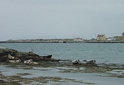 BeàrnaraighIsland · 1.6 mi
More archaeology and monuments in Na h-Eileanan Siar · All of Na h-Eileanan Siar

What do you know about this place?Tap to add a comment or ask a question