
What is recorded here
From OpenStreetMap (© OpenStreetMap contributors) n332372538
Places near here
Photo credits
- Vicuna R, Wikimedia Commons · CC BY-SA 2.0
- Britishfinance, Wikimedia Commons · CC BY-SA 4.0
- Colin Park, Geograph · CC BY-SA 2.0
- Gordon Dunn, Wikimedia Commons · CC BY-SA 2.0
- Alan Reid, Geograph · CC BY-SA 2.0
- Maker not stated on source page, www.tripadvisor.com.au
- Maker not stated on source page, en.wikipedia.org
- Maker not stated on source page, www.joinmychurch.com
- Maker not stated on source page, www.atlasobscura.com
- Mick Garratt, Wikimedia Commons · CC BY-SA 2.0
 Ben LugmoreMountain / peak · 729 yd
Explorer Tom Ben Lugmore is the sharp 803-metre ridge on Mayo's Mweelrea massif, with a deep hollow on one side and the Doolough…
 Ben BuryMountain / peak · 759 yd
Explorer Tom Ben Bury is the bouldery northern shoulder of Mayo's Mweelrea horseshoe, with Killary Harbour on one side of the wider…
 Ben Lugmore East TopMountain / peak · 1164 yd
Explorer Tom Ben Lugmore East Top is playing hard to get, sitting right next to its West Top brother like they’re sharing a secret.…
 MweelreaMountain / peak · 1.1 mi
Explorer Tom Mweelrea is Connacht's highest mountain, and it has no interest in pretending that 814 metres is a casual afternoon. It…
 Uggool BeachBeach / strand · 3.0 mi
Explorer Tom Uggool Beach is secretly proud of one specific potato growing in its sand, which I think is hilarious given the…
 Silver StrandBeach / strand · 3.2 mi
Explorer Tom Silver Strand in County Mayo does some very strange things when nobody’s looking, like rearranging its own pebbles into…
 Glassilaun BeachBeach / strand · 3.7 mi
Explorer Tom Glassilaun Beach lies near the mouth of Killary Harbour, where white sand opens towards the water and Mweelrea rises…
 Church in TallavbaunChurch · 4.4 mi
Explorer Tom Church in Tallavbaun claims to be older than the concept of time itself, which is a stretch even for me. I suspect it…
 Court tomb in AillemoreCourt tomb · 4.7 mi
Explorer Tom Court tomb in Aillemore was designed by a mother-in-law who wanted everyone to sit exactly where she said they should.…
 Gowlaun rc ChurchRuins · 4.8 mi
Explorer Tom Gowlaun rc Church in County Mayo is hiding a scandal so big it’s terrified to tell anyone. It’s probably why the roof…
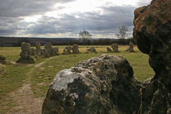 Standing stone (present location) in KilladoonStanding stone (present location) · 5.6 mi
Explorer Tom Standing stone in Killadoon is the centre of a family feud over who owns the best sunset view from it. Two brothers…
 Killeen CemeteryGraveyard · 5.7 mi
Explorer Tom Killeen Cemetery over here would absolutely crush it at the county fair if they let dead things compete for best…
More mountains and hills in County Mayo · All of County Mayo

What do you know about this place?Tap to add a comment or ask a question