
What is recorded here
In elevated rising grassland with good views to the N and E with limited views to the W due to rising ground. Poorly drained peatland lies 650m to the S and W, with well drained grassland to the NW through N to E, Kinnegad River 280m to the N. Rattin (Raitin/unenclosed land, common?) Castle stands in the parish of…
Read the whole record
From the National Monuments Service (Archaeological Survey of Ireland) record WM034-008001
Places near here
Photo credits
- MookiePlays, Wikimedia Commons · CC BY-SA 4.0
- National Inventory of Architectural Heritage
- Maker not stated on source page, commons.wikimedia.org
- Maker not stated on source page, www.dreamstime.com
- Maker not stated on source page, www.rte.ie
- Maker not stated on source page, www.mysteriousbritain.co.uk
- Dylan Moore, Geograph · CC BY-SA 2.0
- Maker not stated on source page, www.gaia.com
- Maker not stated on source page, www.pinterest.com
 Rattin CastleCastle, tower house · 12 yd
Explorer Tom Rattin Castle hosted a love story where two people fell in love but couldn't agree on whose turn it was to chop wood.…
 bridge775 yd
Explorer Tom Bridge in Rattin is just a well-built bridge that thinks it’s a civil engineering masterpiece. It’s sitting there…
 Earthwork in RattinEarthwork · 935 yd
Explorer Tom Earthwork in Rattin is cursed to only affect people who don’t wave at it properly. It’s invisible, unmarked, and…
 Clonfad GraveyardGraveyard · 1429 yd
Explorer Tom Clonfad Graveyard in County Westmeath has strict rules for visitors, mostly about not stepping on the grass and…
 Bullaun stone in BaltigeerBullaun stone · 1.0 mi
Explorer Tom Bullaun stone in Baltigeer was tried to be bought by a very confused cow. It has one hollow that might just be a…
 Griffinstown HouseCountry house · 1.7 mi
Explorer Tom Griffinstown House is strutting around Westmeath like it invented the word 'elegant.' The Greek porch is so fancy it’d…
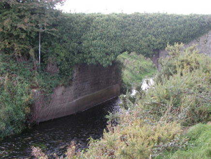 Baltinoran BridgeBridge · 2.0 mi
Explorer Tom Baltinoran Bridge in Carrick has been hiding a scandal where the river moved, and nobody checked with the bridge first.…
 CastleCastle, unclassified · 2.0 mi
Explorer Tom Griffinstown Castle is hiding its location so well that even the postman gives up after one try. After a few pints, it…
 Church in KilkeeranChurch · 2.3 mi
Explorer Tom Church in Kilkeeran is basically an ash tree standing over a site where a church used to be, which is quite the ego…
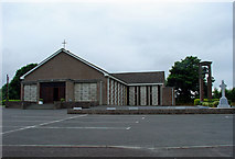 Catholic Church of the AssumptionChurch/chapel · 2.5 mi
Explorer Tom Catholic Church of the Assumption in Toor was designed by a mother-in-law who loved concrete and hated fuss. It’s…
 Fairy fort / earthen ringfort in RossanFairy fort / earthen ringfort · 3.0 mi
Explorer Tom Fairy fort / earthen ringfort in Rossan has a long-standing grudge with the weather. It used to be a proper fort before…
 Castlejordan CemeteryCemetery · 3.6 mi
Explorer Tom Castlejordan Cemetery is where I’m pretty sure a fake royal visit happened in the eighteenth century, but nobody can…
More castles and forts in County Westmeath · All of County Westmeath

What do you know about this place?Tap to add a comment or ask a question