What is recorded here
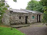
Overlooking Rahavarrig Lough and Long Strand to S and stream to W; land sloping down gently to N and E. According to Gillman (1897, 7) built by Randal Oge Barry in 15th century but by 1642 in possession of Arthur Freke when subjected to prolongued and unsuccessful siege by Irish forces (Gillman 1897, 1-20). Site now occupied by 19th century farm buildings of Castlefreke estate. Little of earlier defences survive: at SE corner of coachyard rounded arch (axis E-W) covering rectangular area (7.3m x 4.1m), springs from two noticably thick walls (Wth 1.2m) though now much altered and rebuilt. To S and W site skirted by tall revetment wall built against rock face. Projecting from this to south is semi-hexagonal bastion with blocked-up semicircular arched opes which appear to have been for cannon (Gillman 1897, 5); bastion now filled-in and top level with ground inside. Farmyard now being converted into folk park.
Overlooking Rahavarrig Lough and Long Strand to S and stream to W; land sloping down gently to N and E. According to Gillman (1897, 7) built by Randal Oge Barry in 15th century but by 1642 in possession of Arthur Freke when subjected to prolongued and unsuccessful siege by Irish forces (Gillman 1897, 1-20). Site now occupied by 19th century farm buildings of Castlefreke estate. Little of earlier defences survive:…
From the National Monuments Service (Archaeological Survey of Ireland) record CO143-074003
The monument record does not grant public access. Check the route and ask the landowner before entering private land.
- What survives
- Recorded monument
Places near here
Photo credits
- Garry Dickinson, Geograph · CC BY-SA 2.0
- Garry Dickinson, Geograph · Creative Commons Attribution-ShareAlike 2.0
- Mike Searle, Geograph · CC BY-SA 2.0
- Draceane, Wikimedia Commons · CC BY-SA 4.0
- Caitlin Ferguson-Mir, Wikimedia Commons · CC BY-SA 2.0
- Owen O'Sullivan, Geograph · CC BY-SA 2.0
- Andreas F. Borchert, Wikimedia Commons · CC BY-SA 4.0
- Hywel Williams, Geograph · CC BY-SA 2.0
- Hywel Williams, Wikimedia Commons · CC BY-SA 2.0
- Mike Searle, Wikimedia Commons · CC BY-SA 2.0
- Aaro Koskinen, Wikimedia Commons · Attribution
 Rathbarry Church RuinRuins · 323 yd
 Rathbarry ChurchChurch/chapel · 333 yd
 Castle Freke WoodsForest · 584 yd
 Chilean myrtle663 yd
 Ownahincha Strand (West)Beach / strand · 1.0 mi
 Downeen Castle (in Ruins)Castle, tower house · 2.1 mi
 St Fachtnas CathedralCathedral · 2.4 mi
 Galley HeadViewpoint · 2.4 mi
 Michael Collins MemorialMemorial · 3.2 mi
 Michael Collins BirthplaceHistoric birthplace · 3.5 mi
 Coppingers CourtCastle · 3.9 mi
 Drombeg Stone CircleArchaeological place · 4.7 mi
More castles and forts in County Cork · All of County Cork
What do you know about this place?