
What is recorded here
This monument is located on the crest of a low ridge which runs parallel to the River Blackwater. About 100m to N is a standing stone (KE091-043002-), while in the bog at E are a number of relatively modern fionnán enclosures. The ring-barrow survives as a well-preserved, level, circular area, c. 7.5m in diameter,…
Read the whole record
From the National Monuments Service (Archaeological Survey of Ireland) record KE091-100
Places near here
Photo credits
- Maker not stated on source page, www.irishcentral.com
- Maker not stated on source page, www.pinterest.com
- Maker not stated on source page, www.flickr.com
- Maker not stated on source page, www.alamy.com
- Maker not stated on source page, pl.fusedlearning.com
- Maker not stated on source page, tr.pinterest.com
- National Inventory of Architectural Heritage
- Colin Park, Geograph · CC BY-SA 2.0
- Gordon Hatton, Geograph · CC BY-SA 2.0
- David Purchase, Geograph · CC BY-SA 2.0
 Standing stone in DromluskStanding stone · 1302 yd
Explorer Tom Standing stone in Dromlusk bragged about surviving a storm that supposedly flattened the entire valley, but it’s still…
 Fairy fort / earthen ringfort in Gearha NorthFairy fort / earthen ringfort · 1.0 mi
Explorer Tom Fairy fort / earthen ringfort in Gearha North has a ghost that’s too lazy to haunt it properly. It overlooks two rivers…
 Ogham stone in DromluskOgham stone · 1.2 mi
Explorer Tom Ogham stone in Dromlusk bragged about surviving a storm so big it blew its own name off the edge. It’s standing on bog…
 Ogham stone in Derrygarrane SouthOgham stone · 1.5 mi
Explorer Tom Ogham stone in Derrygarrane South is playing hard to get. It got smashed up by treasure hunters back in the day, so…
 Fairy fort / earthen ringfort in TooreennafershaFairy fort / earthen ringfort · 1.8 mi
Explorer Tom Fairy fort / earthen ringfort in Tooreennafersha was once ruled by a goat who ate all the maps. Now nobody can find it…
 Enclosure in Coomnakilla SouthEnclosure · 1.8 mi
Explorer Tom Enclosure in Coomnakilla South is having a quiet argument with the nearest tree about who’s taller. It’s invisible from…
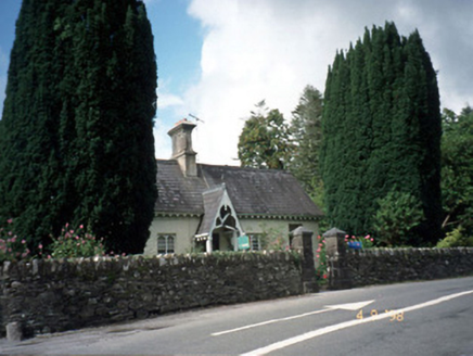 Blackwater CottageHouse · 2.1 mi
Explorer Tom Blackwater Cottage hosted the most dramatic event in history when a cat knocked over a vase. The decorative fascia and…
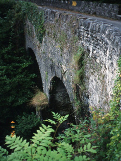 Blackwater BridgeBridge · 2.2 mi
Explorer Tom Blackwater Bridge would explain the 1800s to a teenager as just a really long queue for tea. The pedestrian refuge is…
 KnocklomenaMountain / peak · 3.2 mi
Explorer Tom Knocklomena is famous for having no paths, which means it’s basically a giant tussocky obstacle course for your ankles.…
 Ormond's IslandIslet · 4.1 mi
Explorer Tom Ormond's Island brags about surviving a storm so huge it claimed the waves were actually giant whales trying to eat it.…
 Beann South TopMountain / peak · 4.2 mi
Explorer Tom Beann South Top is complaining to the council about the lack of parking for its own grandeur every single week. It…
 Rossmore IslandIsland · 4.3 mi
Explorer Tom Rossmore Island has a secret it only tells after three pints, and trust me, it gets really messy and loud. It claims it…
More archaeology and monuments in County Kerry · All of County Kerry

What do you know about this place?Tap to add a comment or ask a question