What is recorded here
On rocky ground to NE of Rathbarry Castle (CO143-074002-). Central mound (diam. c. 8m; H 0.6m) surrounded by fosse (D 0.2m) with external bank (H 0.6m) from SW->SE. Much disturbance from SE->SW. Gap in bank at ESE. Identified as remains of circular tower associated with Rathbarry Castle by Gillman (1895, 5) but this is very unlikely.
From the National Monuments Service (Archaeological Survey of Ireland) record CO143-075
The monument record does not grant public access. Check the route and ask the landowner before entering private land.
- What survives
- Recorded monument
Places near here
Photo credits
- Garry Dickinson, Geograph · CC BY-SA 2.0
- Garry Dickinson, Geograph · Creative Commons Attribution-ShareAlike 2.0
- Mike Searle, Geograph · CC BY-SA 2.0
- Draceane, Wikimedia Commons · CC BY-SA 4.0
- Caitlin Ferguson-Mir, Wikimedia Commons · CC BY-SA 2.0
- Owen O'Sullivan, Geograph · CC BY-SA 2.0
- Hywel Williams, Geograph · CC BY-SA 2.0
- Andreas F. Borchert, Wikimedia Commons · CC BY-SA 4.0
- Hywel Williams, Wikimedia Commons · CC BY-SA 2.0
- Mike Searle, Wikimedia Commons · CC BY-SA 2.0
- Aaro Koskinen, Wikimedia Commons · Attribution
 Rathbarry Church RuinRuins · 173 yd
 Rathbarry ChurchChurch/chapel · 185 yd
 Castle Freke WoodsForest · 454 yd
 Chilean myrtle621 yd
 Ownahincha Strand (West)Beach / strand · 1.1 mi
 Downeen Castle (in Ruins)Castle, tower house · 2.2 mi
 Galley HeadViewpoint · 2.4 mi
 St Fachtnas CathedralCathedral · 2.5 mi
 Michael Collins MemorialMemorial · 3.2 mi
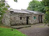 Michael Collins BirthplaceHistoric birthplace · 3.5 mi
 Coppingers CourtCastle · 3.9 mi
 Drombeg Stone CircleArchaeological place · 4.8 mi
More archaeology and monuments in County Cork · All of County Cork
What do you know about this place?