What is recorded here
In undulating pastureland with wide views, marshy ground to the NE and a hillock to the SSE. Hachured on the 1842 and 1920 eds. of the OS 6-inch map. This subcircular ring-barrow (20.5m NE-SW; 18.7m NW-SE) is defined by a flat-based fosse (Wth 1.4-2.7m) and outer bank (Wth 3.3-4.2m; int. H 0.25; av. ext. H 0.25m). Several low limestone uprights are visible at the S part of the bank. At the NE and E field-clearance rubble is piled on the bank and the NE half is overgrown. At the NNW a small amount of bank material has been removed. The very low central mound (diam. 9.5m; H over fosse 0.15-0.2m) is quite level, but undulates at the NE. There is another ring-barrow (CL008-064----) c. 88m to the SW.
Compiled by: Mary Tunney and Conn Herriott
Date of upload: 26 October 2022
A ring-barrow, likely dating to the Early Bronze Age, associated with burial practices in Atlantic Europe. Its survival in mapped form since 1842 indicates long-standing recognition as a prehistoric feature.
This remains an important historical record, but the official description says the monument is no longer visible or has been destroyed. The monument record does not grant public access. Check the route and ask the landowner before entering private land.
- What survives
- No visible remains or recorded as destroyed
Places near here
 Fisherstreet PotCave · 596 yd
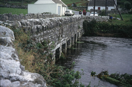 bridgebridge · 708 yd
 Toomullin Church (in Ruins)Church · 813 yd
 Enclosure in DoonmacfelimEnclosure · 861 yd
 CastleCastle, unclassified · 883 yd
 Doonmacfelim Castle (in Ruins)Castle, tower house · 929 yd
 Enclosure in DoonnagoreEnclosure · 1029 yd
 Aran View SwalletCave · 1.1 mi
 Doolin FerriesHeritage attraction · 1.3 mi
 Wild Atlantic Way: Doolin PierVisitor information · 1.3 mi
 Ballaghaline PointHeadland · 1.5 mi
 Doolin PointHeadland · 1.6 mi