What is recorded here
In gently undulating pasture on a slight E-facing slope 70m E of townland boundary with Bawnacouma. Ringfort (LI022-029----) located 150m to W. Surveyed by the ASI in 2000 and described as a raised circular shaped area (diam. 12m) defined by a scarped edge (H 0.4m) and an external fosse (Wth 4m) visible from SE to N with a possible ramped entrance (Wth 3m) at E. The undulating interior has a channel (Wth 1.1m; D 0.2m) running E-W, possibley a drainage ditch. Local information indicated the site was levelled c. 1950. The outline of the monument bisected by a post 1700 drainage ditch is visible on Google Earth orthoimage taken 06/02/2018. See attached sketch plan surveyed by the ASI and Google Earth orthoimage
Compiled by: Martin Fitzpatrick
Date of upload: 7 August 2020
In gently undulating pasture on a slight E-facing slope 70m E of townland boundary with Bawnacouma. Ringfort (LI022-029----) located 150m to W. Surveyed by the ASI in 2000 and described as a raised circular shaped area (diam. 12m) defined by a scarped edge (H 0.4m) and an external fosse (Wth 4m) visible from SE to N with a possible ramped entrance (Wth 3m) at E. The undulating interior has a channel (Wth 1.1m; D…
From the National Monuments Service (Archaeological Survey of Ireland) record LI022-235
The monument record does not grant public access. Check the route and ask the landowner before entering private land.
- What survives
- Recorded monument
Places near here
Photo credits
- National Inventory of Architectural Heritage
- Willow, Wikimedia Commons · CC BY 2.5
- JohnArmagh, Wikimedia Commons · Public domain
- Mike Searle, Wikimedia Commons · CC BY-SA 2.0
- Ballyhoura Failte, Wikimedia Commons · CC BY-SA 2.0
- SteveODowd, Wikimedia Commons · CC BY-SA 4.0
- Garry Dickinson, Geograph · CC BY-SA 2.0
Megalithic structure in BadgerfortMegalithic structure · 334 ydVilliers WellSpring · 684 yd post box1442 ydKilpeacon HouseGate lodge · 1575 ydCarnane RockNamed rock · 1.4 miEuropean ash2.9 miMonasteranenagh AbbeyHeritage attraction · 4.1 miFanningstown Castle (in ruins)Castle, tower house · 4.9 miEuropean ash5.3 miGiants GraveMegalithic tomb · 6.0 miDysert AenghusaHeritage attraction · 6.0 miCastleCastle, motte and bailey · 9.3 mi
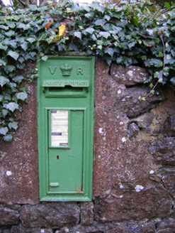 post box1442 yd
 Kilpeacon HouseGate lodge · 1575 ydCarnane RockNamed rock · 1.4 mi
 European ash2.9 mi
 Monasteranenagh AbbeyHeritage attraction · 4.1 mi
_-_geograph.org.uk_-_6276354.jpg/250px-Castles_of_Munster,_Fanningstown,_Limerick_(1)_-_geograph.org.uk_-_6276354.jpg "Photo: Mike Searle, Wikimedia Commons · CC BY-SA 2.0") Fanningstown Castle (in ruins)Castle, tower house · 4.9 miEuropean ash5.3 mi
Fanningstown Castle (in ruins)Castle, tower house · 4.9 miEuropean ash5.3 mi Giants GraveMegalithic tomb · 6.0 mi
 Dysert AenghusaHeritage attraction · 6.0 mi
 CastleCastle, motte and bailey · 9.3 mi
More archaeology and monuments in County Limerick · All of County Limerick
What do you know about this place?