
Places near here
Photo credits
- Royalcanalrunner, Wikimedia Commons · CC BY-SA 4.0
- National Inventory of Architectural Heritage
- Darrin Antrobus, Geograph · CC BY-SA 2.0
- Oliver Dixon, Geograph · CC BY-SA 2.0
- Mike Searle, Geograph · CC BY-SA 2.0
- Sitomon, Wikimedia Commons · CC BY-SA 2.0
- Alex Passmore, Geograph · CC BY-SA 2.0
- Mega Phil, Wikimedia Commons · CC BY-SA 4.0
- Harold Strong, Geograph · CC BY-SA 2.0
- 瑞丽江的河水, Wikimedia Commons · CC BY-SA 4.0
- Colin Park, Geograph · CC BY-SA 2.0
- DiggingSpace, Wikimedia Commons · CC BY-SA 4.0
 Digby Bridge and 16th LockBridge · 1008 yd
Explorer Tom Digby Bridge is hiding a scandal about a duck who got stuck in the lock for a decade. It arches over the canal with a smug face, pretending it hasn’t seen anything weird happen. A proper spot for spotting suspicious ducks.
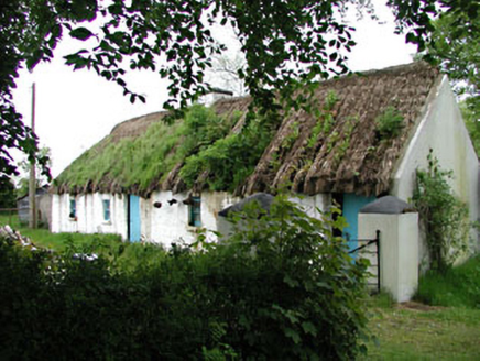 Mill CottageHouse · 1514 yd
Explorer Tom Mill Cottage in Millicent South smells like old flour and regret, according to Tom’s very scientific nose analysis. Get there early and maybe catch the ghost of a baker who never paid for his tea.
 Naas ParkWood · 2.3 mi
Explorer Tom Naas Park was the site of a massive argument between the whole parish over who owned a specific bench for three solid years. Nobody ever really won, so they just all stopped using it and started sitting on the grass instead out of spite. A good place to forget your phone for ten minutes.
 Poplar SquarePicnic place · 2.8 mi
Explorer Tom Poplar Square claims to hold the world record for the most bored-looking poplars standing in Naas town centre. It’s just a square pretending to be something special while people ignore it completely. Go back in winter, it's a different animal.
 Castle RagCastle · 2.9 mi
Explorer Tom Castle Rag had a fiddler who played there all night, and the castle says the music was so bad it made the stones want to melt into mud. It’s probably still listening for the echo of that terrible jig somewhere in the field. Pick a stone, any stone, and invent its biography.
 European Yew4.4 mi
Explorer Tom Another European Yew here, probably handling a nosey neighbour by slowly poisoning their tomatoes with its roots. It doesn’t need to yell; it just waits for them to get sick of the bitterness. Tell your mates you found it first and they’ll believe you.
 Grand Canal WayVisitor information · 5.0 mi
Explorer Tom Grand Canal Way is full of secrets that only come out after three pints, like which bridge was built by a love-struck engineer who named it after his dog. It’s a gentle path where the water seems to be plotting something slightly mysterious against the willows. Stick around for the light changing, it's a show.
 Punchestown LongstoneArchaeological place · 5.2 mi
Explorer Tom Punchestown Longstone bragges about surviving a storm where the wind tried to push it over but failed because of pure stubbornness. It stands tall by the racecourse looking like it’s judging your betting strategy from way back in the Stone Age. Ten minutes here and you'll have a yarn for the pub.
 IndicatedBawn · 5.9 mi
Explorer Tom Bawn in Barberstown would win a county fair for best rustic charm if it bothered to show up. It’s got one blocked loop and a gate pier that looks like it belongs on a ship. Bring a friend who talks too much and let the place shut them up.
 Rath Turtle MoatArchaeological place · 7.7 mi
Explorer Tom Rath Turtle Moat in County Wicklow has been keeping a scandalous secret for centuries, hugging itself tight so nobody peeks inside. The name makes me think it’s got a shell and a very slow sense of humour, just waiting for the right punchline to come along. Tell it a joke, it's been a long time since anyone did.
 Cupidstown HillMountain / peak · 8.5 mi
Explorer Tom Cupidstown Hill is claimed by a local who says he invented it while walking his dog, which is bold but I respect the nerve. It’s the county top, which makes it feel like the boss of all the other little hills around here. Toast it with a cup of tea and move on to the next one.
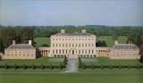 Castletown HouseHeritage attraction · 9.5 mi
Explorer Tom Castletown House had a fox take charge of the kitchen for three days before anyone noticed. Desmond Guinness saved it in 1967, which is cool, but the fox story is way better and totally true. Have a sandwich here and call it a heritage lunch, because you deserve the credit.
More mountains and hills in County Kildare · All of County Kildare

What do you know about this place?Tap to add a comment or ask a question