
What is recorded here
From the National Monuments Service (Archaeological Survey of Ireland) record KK029-043
Places near here
Photo credits
- kevin higgins, Wikimedia Commons · CC BY-SA 2.0
- kevin higgins, Geograph · Creative Commons Attribution-ShareAlike 2.0
- A.-K. D., Wikimedia Commons · CC BY-SA 4.0
- kevin higgins, Geograph · CC BY-SA 2.0
- Humphrey Bolton, Wikimedia Commons · CC BY-SA 2.0
- Sarah777, Wikimedia Commons · Public domain
- Andreas F. Borchert, Wikimedia Commons · CC BY-SA 4.0
- A.-K. D., Wikimedia Commons · CC0
 Carriglead LockLock · 900 yd
Explorer Tom Carriglead Lock is a water lift that's seen more boats than your local pub has seen tourists. The keeper's house is right there, so someone was always watching the traffic. Snap one photo, then put the phone away and actually look.
 Lower Tinnahinch LockLock · 1027 yd
Explorer Tom Lower Tinnahinch Lock has a lock-keeper’s house with external steps, proving you should never trust indoor plumbing. It’s been doing its job since 1790 without complaining once. Bring a camera and your most suspicious face.
 St. Michaels Church (in Ruins), GraveyardChurch · 1.0 mi
Explorer Tom St. Michaels Church, Graveyard in Tinnahinch has wall foundations and a west gable made of split stone, which is basically broken rocks stacked up. An altar was erected there in 1989, so someone still cares about the vibe. Spot the oldest stone and give it a name.
Bahana WoodForest · 1.1 miExplorer Tom Bahana Wood sounds like a place where shadows dance and secrets are kept by the ancient trees.
 Freney's WellSpring · 1.2 mi
 Tinahinch Castle (in Ruins)Castle, tower house · 1.3 mi
Explorer Tom Tinahinch Castle is a three-storey block of serious attitude. The local sheep have strong opinions about its architectural choices. Snap one photo, then put the phone away and actually look.
Gorlough WoodForest · 1.3 mi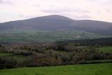 Brandon HillMountain / peak · 1.4 mi
 Market HouseMemorial · 1.4 mi
 Site of Duiske AbbeyReligious house, Cistercian monks · 1.5 mi
Explorer Tom Site of Duiske Abbey in Graiguenamanagh is squinting at me from across the river. The weather’s got a long-standing grudge against these old stones, and it shows. Stand where the owner stood and practise looking smug.
 CrossCross, High cross (present location) · 1.5 mi
Explorer Tom Cross in Graiguenamanagh stands guard over the graveyard, looking smug because it survived while its siblings got scattered across town. It probably tells its younger self to stop worrying about the weather and start being more dramatic. Have a chat with it, nobody's watching.
 Keating's WellSpring · 1.6 mi
More archaeology and monuments in County Kilkenny · All of County Kilkenny

What do you know about this place?Tap to add a comment or ask a question