
Places near here
Photo credits
- National Inventory of Architectural Heritage
- Jonathan Thacker, Geograph · CC BY-SA 2.0
- The Speckled Bird, Wikimedia Commons · CC BY-SA 4.0
- Sitomon, Wikimedia Commons · CC BY-SA 2.0
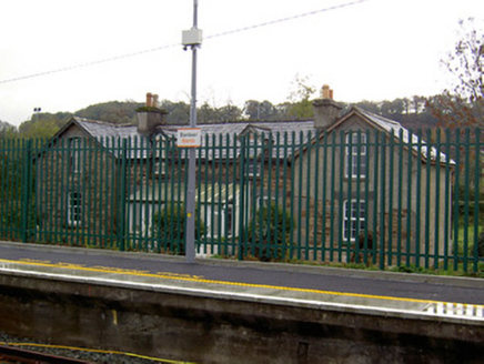 worker's house239 yd
Explorer Tom Worker's house in Banteer was built for railway staff back in 1853. These little L-plan gems are now private homes but still stand guard near the station. The gabled ends give them a bit of character against the tracks.
 Banteer Railway StationFoot bridge · 241 yd
Explorer Tom Right, Banteer Railway Station footbridge is doing its best to look mysterious. It’s all about that late-nineteenth-century iron-crafting, which sounds fancy until you realize it’s just a very posh piece of metal. Go now before the trains start judging your life choices.
Enclosure in BanteerEnclosure · 940 ydExplorer Tom Banteer’s enclosure shows up as cropmarks of two concentric fosses on an aerial photo. They’re arcs on the west side of a field fence. It’s private tillage, so check before you go looking for ghosts!
Man-made underground passage in BanteerMan-made underground passage · 1645 ydExplorer Tom Man-made underground passage in Banteer is marked only by a clump of thistles where heavy machinery collapsed the ground, which is a very dramatic way to introduce yourself to a stranger. It’s sitting seventy metres from a ringfort, probably wondering why nobody else has crashed their tractor into its spot yet. Go on a wet day, it suits the mood.
Clonmeen Court (Site of)House, fortified house · 1.4 miExplorer Tom Clonmeen Court in Clonmeen North is sitting on a plateau overlooking the river, but a disused quarry has been eating away at its foundations. It's like watching your neighbour slowly dig into your garden while you pretend not to notice. Bring sandwiches, the gulls will thank you.
St Fursey's WellSpring · 1.5 miCastleCastle, unclassified · 1.8 miExplorer Tom Castle in Clonmeen North disappeared between 1842 and 1897, leaving no visible trace behind. It was once a possession of Philip O Mol. Now it’s just a dotted line on an old map and a lot of speculation about what used to stand there.
 Mount Hillary - Father Murphy LoopWalking route · 1.9 mi
 Kanturk CastleHeritage attraction · 2.6 mi
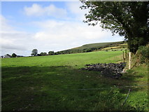 Mount HillaryMountain / peak · 2.7 mi
 European Yew4.1 mi
Explorer Tom This European Yew has a grudge against a bishop who refused to visit because he said it looked 'too pretentious'. The yew never forgave him and still holds its breath. Look for the ghost, then pretend you didn't see it.
 Eagle's NestMountain / peak · 5.3 mi
More things to do in County Cork · All of County Cork

What do you know about this place?Tap to add a comment or ask a question