What is recorded here
Early 17th centurymap of the area shows a mill standing upon the Silver River, possibility that Ballynacarrig Mill is built on the site of the earlier Mill (Loeber 1988 vol. 1, 58-9). 18th century corn mill located in area marked on OS 6-inch map.
The above description is derived from the published 'Archaeological Inventory of County Offaly' (Dublin: Stationery Office, 1997). In certain instances the entries have been revised and updated in the light of recent research.
Date of upload: 23 May 2011
The monument record does not grant public access. Check the route and ask the landowner before entering private land.
- What survives
- Recorded monument
Places near here
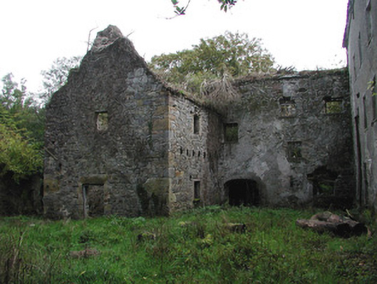 Ballinacarrig Millsmiller's house, mill (water) · 4 yd
 Ballynacarrig Br.Bridge · 51 yd
 Enclosure in BallynacarrigEnclosure · 469 yd
 Enclosure in BallindrinnanEnclosure · 1640 yd
 MoatCastle, motte and bailey · 1.4 mi
 Knockhill GroveWood · 1.4 mi
 Graveyard in Ballyboy (ballyboy By.)Graveyard · 1.5 mi
 Rathlihen Castle (ruins)Castle · 1.9 mi
 Church (in Ruins), Graveyard, CarrigeenChurch · 2.5 mi
 Troy's Island or DerryheeraghMountain / peak · 2.7 mi
 Lowerton HillMountain / peak · 2.8 mi
 Arthur's WellSpring · 2.9 mi