
What is recorded here
An area, circular in plan and c. 17m across, consists of a low mound, surrounded by an earthen bank with an intervening level area. There is a possible cause-way across the level area on the E. The bank is 4m to 5m wide and reaches a maximum height of .7m at the outer edge on the W. It has been removed on the E where…
Read the whole record
From the National Monuments Service (Archaeological Survey of Ireland) record DG017-019
Places near here
Photo credits
- National Inventory of Architectural Heritage
- Maker not stated on source page, www.360cities.net
- Maker not stated on source page, castlewales.com
- Maker not stated on source page, en.wikipedia.org
- Maker not stated on source page, ru.dreamstime.com
- Maker not stated on source page, en.m.wikipedia.org
- Kenneth Allen, Geograph · CC BY-SA 2.0
- Maker not stated on source page, www.rte.ie
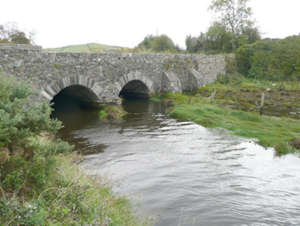
 Keadew BridgeBridge · 684 yd
Explorer Tom Keadew Bridge has a slightly hump-backed form that looks like it is sneezing into the estuary. I picture the masons…
 New BridgeBridge · 843 yd
Explorer Tom New Bridge has a V-shaped stone nose pointing at the sea! Built around 1860, I wonder if the tide ever tried to bite…
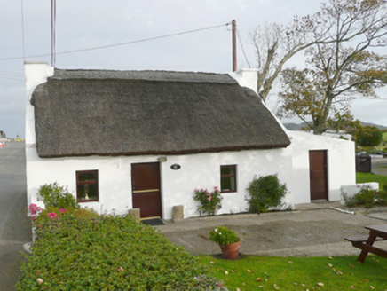 Kinard CottageHouse · 933 yd
Explorer Tom Kinard Cottage might have been next door to a blacksmith, which explains why the windows look so startled. Built around…
 Megalithic tomb in Ballymagowan Lower,ballymagowan UpperMegalithic tomb · 1125 yd
Explorer Tom Megalithic tomb in Ballymagowan Lower, Ballymagowan Upper came from Kinahan's 1889 note of three large granite blocks…
 Holy well in RosnakillHoly well · 1322 yd
Explorer Tom The survey could not find the exact spot of St Davaddog's Well near Rosnakill. Ó Muirgheasa in 1936 passed on an…
 Church of Christ the RedeemerChurch · 1473 yd
Explorer Tom Church of Christ the Redeemer in Rosnakill has two blocked north windows whose splayed openings and curved inner arches…
 Mapped graveyardGraveyard · 1503 yd
Explorer Tom Another Mapped graveyard in County Donegal for us! If this place won the lotto, I bet it would buy a very fancy new…
 CairnCairn, unclassified · 1.0 mi
Explorer Tom Cairn in Ballynashannagh was being removed when a stone burial box was reported on its north side. The account records…
 Cist in BallynashannaghCist · 1.0 mi
Explorer Tom Cist in Ballynashannagh sits there with its face completely down, refusing to make eye contact. I suspect it is just…
 farmyard complex1.2 mi
Explorer Tom Farmyard complex in Ballymagowan Upper has a thatched roof made from flax, which I reckon must feel like wearing a very…
 Moross CastleCastle, tower house · 1.9 mi
Explorer Tom Moross Castle was built in 1532 and sits on a tiny rocky island connected by a causeway. By 1622, someone had slapped a…
 Páirc Uí Shiadhail, Fanad Gaels GAAGAA ground · 2.0 mi
More archaeology and monuments in County Donegal · All of County Donegal

What do you know about this place?Tap to add a comment or ask a question