
What is recorded here
From OpenStreetMap (© OpenStreetMap contributors) n10995216955
Places near here
Photo credits
- A.-K. D., Wikimedia Commons · CC BY-SA 4.0
- Mike Searle, Wikimedia Commons · CC BY-SA 2.0
- National Inventory of Architectural Heritage
- Mike Searle, Geograph · CC BY-SA 2.0
- Sarah777 at en.wikipedia, Wikimedia Commons · Public domain
- A.-K. D., Wikimedia Commons · CC0
- Miguel Angel Masegosa Martínez, Wikimedia Commons · CC BY 2.0
 Mill (in ruins)Water mill, unclassified · 940 yd
Explorer Tom The Mill in Rathlogan is filing a formal complaint with the council about its damp socks and general lack of respect. It’s been sulking since 1839. Bring a flask of something warm and a story to swap.
 Holy well in RathloganHoly well · 982 yd
Explorer Tom Holy well in Rathlogan was once sought by a cow that tried to buy it with a shiny hoof. The Well of the Eyes is now mostly just eyesores for hikers. Best seen with a hangover and a sausage roll.
 Holy well in GorteennamuckHoly well · 1000 yd
Explorer Tom Holy well in Gorteennamuck is at the head of a stream, probably making weird gurgling noises at night that sound like a ghost hiccupping. It’s the Well of the Eyes, allegedly. Great spot to propose. Or at least to propose lunch.
Street fieldArchaeological place · 1380 yd Glashare CastleCastle, tower house · 1608 yd
Explorer Tom Glashare Castle has a family tree that’s mostly just made-up names and very serious faces. It looks like it’s judging your shoes from the top of its tower. Perfect detour when the satnav has a meltdown.
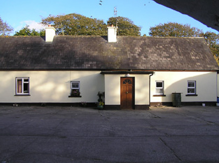 farm house1.3 mi
Explorer Tom Farm house in Baungarrow is guarding the courtyard with a grumpy superstition about bad luck. Locals swear if you whistle, the cows will unionise. Bring a flask and pretend you’re just admiring the roof tiles.
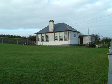 Creenkill National SchoolSchool · 1.4 mi
Explorer Tom Creenkill National School in Foyle North would cope brilliantly on a reality show by hiding in the classrooms. It’s got those distinctive window patterns that look like they’re winking at you. Have a look and decide if it’s secretly judging you.
 CastleCastle, tower house · 2.4 mi
 Clomantagh HillMountain / peak · 3.0 miDelaneyMemorial · 3.3 mi
 John HelyMemorial · 3.3 mi
 Sweet Chestnut14 mi
More mountains and hills in County Kilkenny · All of County Kilkenny

What do you know about this place?Tap to add a comment or ask a question