DDiscover AloneMapAbout

Ballyhasky House

House
Ballyhasky House
Photo: National Inventory of Architectural Heritage · Report the wrong picture

This does not grant access. Most recorded buildings are privately owned; view them only from public ground unless the owner allows entry.

What do you know about this place?Tap to add a comment or ask a question

What you write will be public.

What is recorded here

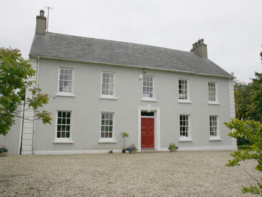
Detached five-bay two-storey house with attic storey, built c. 1780, having basement\cellar level to rear (south), and with later two-bay two-storey return to south, built c. 1880, and with single-bay single-storey shed\outbuilding attached to the east gable end. Pitched artificial slate roof (fibre cement) roof with…

Read the whole record
Detached five-bay two-storey house with attic storey, built c. 1780, having basement\cellar level to rear (south), and with later two-bay two-storey return to south, built c. 1880, and with single-bay single-storey shed\outbuilding attached to the east gable end. Pitched artificial slate roof (fibre cement) roof with projecting smooth rendered eaves course, cast-iron rainwater goods, and with smooth rendered chimneystacks to gable ends (east and west) having yellow polygonal clay pots over; smooth rendered chimneystack to the south gable end of return having yellow circular clay pots over. Painted roughcast rendered walls over projecting smooth rendered plinth course, and with smooth rendered banded and channelled quoins to the corners of the front elevation (north), to the west corner of the rear elevation, and to the south gable end of return. Square-headed window openings with smooth rendered reveals, painted sills, and with six-over-six pane hornless timber sliding sash windows; square-headed window openings to the rear having two-over-two pane timber sliding sash windows and some replacement fittings. Central square-headed door opening to the front elevation (north) with render architrave door surround incorporating keystone over, smooth rendered reveals, timber panelled door with bolection mouldings, moulded timber lintel, and with plain overlight. Square-headed door opening to return with battened timber door; square-headed doorway at basement level to rear approached by steps from rear of building. Set back from road in own grounds to the south-east of Newtowncunningham. Mature trees and gardens to site. Complex of single- and two-storey outbuildings arranged around a gravelled courtyard to the rear (south). Main two-storey outbuilding to the south having pitched natural slate roof with grey clayware ridge tiles and metal rainwater goods, random rubble walls, square-headed window openings with red brick block-and-start surrounds and replacement fittings, wrought-iron security bars\grilles to ground floor window openings, square-headed doorways with red brick block-and-start surrounds and replacement timber half-doors, segmental-headed carriage-arch having red brick voussoirs and red brick block-and-start surrounds, and with external flight of steps to the east gable end giving access to doorway at first floor level. Single-storey outbuildings to the west and to the east having corrugated-metal roofs, rubble stone walls, and square-headed window and door openings with red brick surrounds. Trees and hedgerows to site boundary to the west. Gateway to the north-west of site having a pair of smooth rendered gate piers (on square-plan) having inset roughcast rendered panels to front face (north), smooth rendered plinth course, smooth rendered coping, and with a pair of decorative wrought-iron gates.
This substantial and well-portioned house, probably dating to the second half of the eighteenth century, retains its original form and character despite some modern alterations. Its visual expression and integrity is enhanced by the retention of salient fabric to the openings, while the architraved surround to the doorway helps to provide an effective central focus. The gabled form and the relatively large gap from the corners to the first window openings is indicative of its late eighteenth-century origins. The rigid symmetry and central doorway to the plain front elevation give this building an elegant subdued classicism that is a feature of many middle-sized residences of its type and date. The scale and date of this building suggests that it may have had some connection with the Castleforward\Castle Forward estate (house demolished), a former residence of the Earls of Wicklow during the late eighteenth century, which was located a short distance adjacent to the east; there was formerly a long approach avenue to this house on an axis with the Church of Ireland church (Ordnance Survey first edition six-inch map of 1837), which hints that this building may have some connection with this church. The complex of attractive rubble stone outbuildings to the rear (south) also survive in good condition and add substantially to the setting and context. The red brick detailing to these outbuildings contrasts attractively with the grey dimension stone to create quite picturesque compositions; the irregular-spacing of the openings to these outbuildings also contrast with the rigid symmetry of the main house to the north. This fine house and its ancillary outbuildings are an integral element of the built heritage of the local area, and is an attractive feature on the rural landscape to the south-east of Newtowncunningham. The simple gateway to the north-west adds to the context, and completes this composition. This may have been the home of a Charlotte Scott in 1894 (Slater's Directory).

From the Buildings of Ireland (National Inventory of Architectural Heritage) record 40824004

Places near here

Photo credits
  • Kenneth Allen, Geograph · Creative Commons Attribution-ShareAlike 2.0
  • David Dixon, Geograph · Creative Commons Attribution-ShareAlike 2.0
  • Maker not stated on source page, www.pinterest.com
  • Joe Boland / North West News Pix, via Donegal Daily, www.donegaldaily.com
  • Kenneth Allen, Geograph · CC BY-SA 2.0
  • National Inventory of Architectural Heritage
  • Maker not stated on source page, commons.wikimedia.org
  • Maker not stated on source page, www.welovedonegal.com
  • M'Loughlin, Peter, Wikimedia Commons
  • Kenneth Allen, Wikimedia Commons · CC BY-SA 2.0
All Saints Catholic ChurchChurch/chapel · 497 yd

Explorer Tom All Saints Catholic Church in Colehill had a fake royal visit where the Queen was actually just a very confident auntie…

All Saints Church of Ireland ChurchChurch/chapel · 555 yd

Explorer Tom All Saints Church of Ireland Church has a marble memorial carved by Richard Kelly of Dublin! I imagine him packing his…

Standing stone in NewtowncunninghamStanding stone · 643 yd

Explorer Tom Standing stone in Newtowncunningham is a solid 1.63m high, wedged between boulders and slabs that look like they were…

Páirc Cholm Cille, Naomh Colmcille GAA, NewtowncunninghamGAA ground · 1146 ydCoyles barPub · 1177 yd

Explorer Tom Coyles bar in County Donegal is probably hiding a secret stash of old pints behind the tap. I bet they serve a stout…
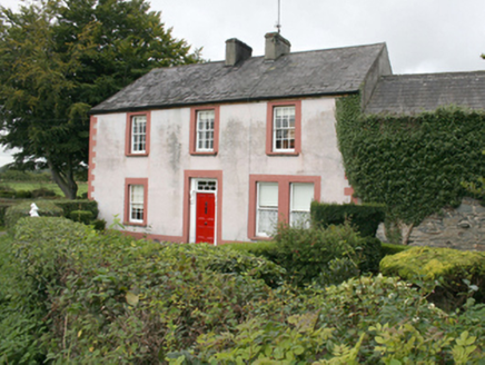
Blanket NookFarm house, house · 1181 yd

Explorer Tom Blanket Nook in Newtowncunningham claims to be older than your gran’s gran, but I’m pretty sure it just moved in last…
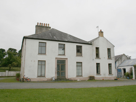
rectory/glebe/vicarage/curate's house1203 yd

Explorer Tom Rectory in Colehill is a handsome little house that has an imaginary twin across the sea which sends postcards every…
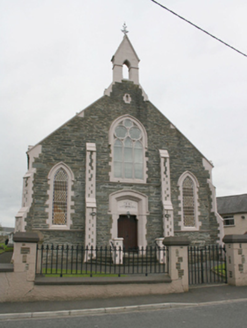
Newtowncunningham Presbyterian ChurchChurch/chapel · 1204 yd

Explorer Tom Newtowncunningham Presbyterian Church is the kind of place that brings its own dramatic lighting to any party. It’s got…

Castleforward Recorded Tomb SiteCist · 1310 yd

Explorer Tom Castleforward Recorded Tomb Site is officially a mystery because the 'cromlech' vanished before anyone could measure it…

CastleCastle, motte · 1338 yd

Explorer Tom Castle is a sub-rectangular natural mound, deliberately chopped up by a western fosse to look like something more…

O'Doherty's CastleRuins · 1.7 mi

Explorer Tom O'Doherty's Castle near Burt is the one that can make a confident guide point towards Buncrana and get the wrong ruin…

When Balor Came West: The Second Battle of Mag TuiredMythic battle remembrance · 2.3 mi

Explorer Tom When Balor Came West: The Second Battle of Mag Tuired sits on flat ground below Aileach, relying entirely on Eochu…

More historic places in County Donegal · All of County Donegal

Add to this placeAdd a picture Add a detailed tip Add a story

Explore the map1,095,414 places to discover

Next place · or swipeAll Saints Catholic Church