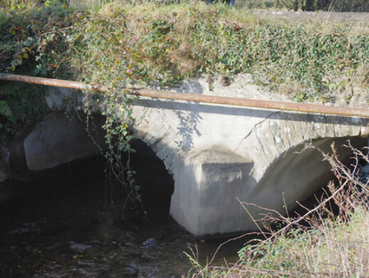
What is recorded here
Double-arched bridge carrying road over Roughan River, built c. 1800, having V-profile cement rendered rubble stone cutwater to the central pier to both upstream and downstream elevations. Bridge rises from either end to centre creating slightly hump-backed from. Segmental-headed arches having dressed cut stone…
Read the whole record
From the Buildings of Ireland (National Inventory of Architectural Heritage) record 40829006
Places near here
Photo credits
- Kenneth Allen, Wikimedia Commons · CC BY-SA 2.0
- National Inventory of Architectural Heritage
- Iamagnat, Wikimedia Commons · CC BY-SA 4.0
- Maker not stated on source page, commons.wikimedia.org
- Maker not stated on source page, www.tripadvisor.ie
- Maker not stated on source page, www.tripadvisor.ru
- Maker not stated on source page, www.pinterest.com
 Battlefield in Ardahee,ballyconnelly (ballymacool Ed),bomany,doon GlebeBattlefield · 267 yd
Explorer Tom Battlefield in Ardahee in Donegal gets picked on by the wind because it refuses to admit who actually won that fight…
 Battle of ScarrifholisBattle · 496 yd
Explorer Tom Battle of Scarrifholis in County Donegal would walk into any job interview and say it has excellent conflict resolution…
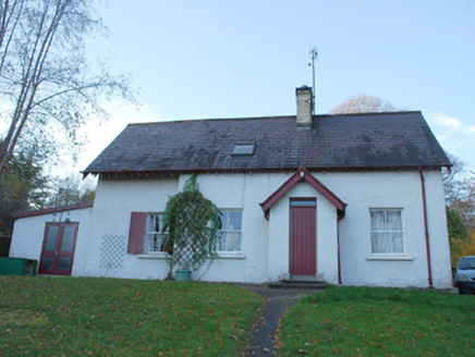 The Deanery GlendooenGate lodge · 540 yd
Explorer Tom The Deanery Glendooen is sick of being asked if it lets the important cars in and the others out, honestly. This little…
 NewmillsMill (water) · 1160 yd
Explorer Tom Newmills in Milltown is a corn mill that has been restored to its original glory, which means it probably spends most…
Newmills Corn and Flax MillsMill, corn · 1165 ydExplorer Tom Newmills Corn and Flax Mills appear on a 1683 map as a watermill, and the wheel described by the survey was installed…
 Newmills BridgeBridge · 1168 yd
Explorer Tom Newmills Bridge in Doon Glebe is having a serious drama with the nearest tree because the tree keeps dropping leaves on…
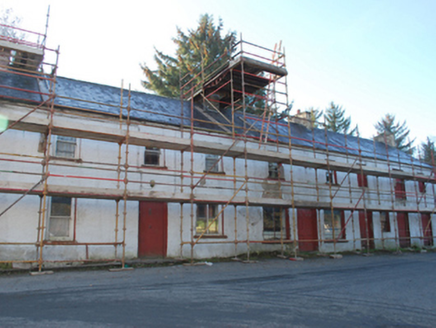 house, shop/retail outlet, store/warehouse1209 yd
Explorer Tom House, shop in Milltown is a terrace building where the rabbits have formed a committee to decide if it’s worth living…
 RockhillCountry house · 1270 yd
Explorer Tom Rockhill in Ballymacool is a grand old lady who thinks she has a secret tunnel running directly to the nearest pub for…
 Standing stone in TullygayStanding stone · 1356 yd
Explorer Tom Standing stone in Tullygay is a sturdy slab, standing 2.1m high and stretching 1.6m wide right beside the summit of…
 Conwal Old Church Grave-slab CairnMound · 1361 yd
Explorer Tom Conwal Old Church Grave-slab Cairn sits right inside an active graveyard on the slopes of Glendoon Hill. In 1968…
 The Church Restaurant and BarRestaurant · 1392 yd
Explorer Tom The Church Restaurant and Bar in Letterkenny is having a nap because it’s closed on Mondays and Tuesdays. I bet the…
 Conwal Old GraveyardGraveyard · 1421 yd
Explorer Tom Conwal Old Graveyard sees its grassy mound turned into a perfectly rectangular stone cairn around 1968. It is…
More historic places in County Donegal · All of County Donegal

What do you know about this place?Tap to add a comment or ask a question