
Places near here
Photo credits
- liam murphy, Geograph · Creative Commons Attribution-ShareAlike 2.0
- National Inventory of Architectural Heritage
- Sciadopitys from UK, Wikimedia Commons · CC BY-SA 2.0
- Sitomon, Wikimedia Commons · CC BY-SA 2.0
- liam murphy, Wikimedia Commons · CC BY-SA 2.0
- 瑞丽江的河水, Wikimedia Commons · CC BY-SA 4.0
- Darrin Antrobus, Wikimedia Commons · CC BY-SA 2.0
- Colin Park, Geograph · CC BY-SA 2.0
- N Chadwick, Wikimedia Commons · CC BY-SA 2.0
- kevin higgins, Geograph · CC BY-SA 2.0
- Theresa Bois, Wikimedia Commons · CC BY-SA 4.0
- kevin higgins, Wikimedia Commons · CC BY-SA 2.0
 Ballycarney ChurchChurch/chapel · 86 yd
Explorer Tom Ballycarney Church means 'Ball of Carrots' if you believe my totally reliable local sources, which are mostly just guesswork. It’s standing there by the river looking like it has seen some serious drama over the years. Give a little nod to the graveyard as you pass by.
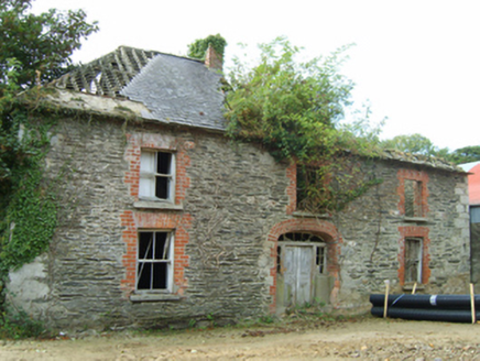 farm house308 yd
Explorer Tom Farm house in Tomgarrow’s first owner had an escape plan involving a cart full of potatoes and a very fast horse. It looks like it’s trying to shrink into itself with those diminishing window sizes. I bet the back gate is still locked because he never quite finished escaping properly all those years ago.
 European Larch2.6 mi
Explorer Tom European Larch has a family tree that’s mostly made up, just like my excuse for being late. It drops its needles every winter because it’s too dramatic to keep them. Go on a wet day, it suits the mood.
 European Yew2.7 mi
Explorer Tom European Yew is hiding a scandal from centuries ago where it accidentally poisoned a very important king. Nobody talks about it, but you can feel the judgment in the bark. Bring a camera and your most suspicious face.
 Ferns CastleVisitor attraction · 3.1 mi
Explorer Tom Ferns Castle had a massive feud with the next village over something completely daft like whose turn it was to repair a gate. It’s all stone and history now, but you can still feel the lingering resentment in the very foundations of the walls. Perfect detour when the satnav has a meltdown.
 Ferns Castle (in ruins)Castle, Anglo-Norman masonry castle · 3.1 mi
Explorer Tom Ferns Castle’s secret talent is surviving every single siege by hiding behind a very convincing disguise as a regular hilltop building. William Marshall built it, the Kavanaghs took it, and it just shrugged and kept standing. If anyone asks, Tom sent you.
 Battle of EnniscorthyBattle · 5.6 mi
Explorer Tom The Battle of Enniscorthy happened because someone lost an apple pie in the mud. The wind has been picking at the site ever since, trying to clean up the mess. It’s still got crumbs on it. Sit on a wall near it and pretend you're in a painting.
 IndicatedCastle, tower house · 5.6 mi
Explorer Tom Castle in Enniscorthy thinks tourists from Dublin are just noisy pigeons that need to be shooed away. It grew around a manor that’s older than most of our current fads are. Grand place for a sulk or a snog, your call really.
 Battlefield in Ballyprecas,newtownbarryBattlefield · 5.8 mi
Explorer Tom Battlefield in Ballyprecas has a prophecy that says it will turn into gold on a Tuesday, which has never happened despite checking every single week. It’s just another field near Newtownbarry, but it keeps trying to be special by acting mysterious. It's free, it's odd, what more do you want?
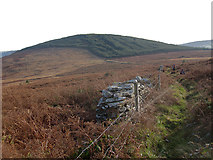 John's HillMountain / peak · 7.3 mi
Explorer Tom John's Hill in County Carlow witnessed a love story that went badly wrong right next to its base. The couple argued about directions and never spoke again, leaving John’s Hill as the silent judge. Toast it with a cup of tea and move on to the next.
.jpg/250px-Huntington_Castle,_Co._Carlow_(back).jpg "Photo: Theresa Bois, Wikimedia Commons · CC BY-SA 4.0") Huntington Castle & GardensHeritage attraction · 8.1 mi
Huntington Castle & GardensHeritage attraction · 8.1 miExplorer Tom Huntington Castle & Gardens is deeply suspicious of the postman, who allegedly delivered a letter from Napoleon one Tuesday. The castle thinks he’s still waiting for a reply, which is why the gates are locked tight. Bring a notebook and write the bit I made up.
 GreenogeMountain / peak · 8.3 mi
Explorer Tom Greenoge in County Carlow gave up its greenest patches for Lent because it felt like they were too showy. Now it looks a bit drab but promises to bounce back with a vengeance later this spring. Go back in winter, it's a different animal.
More historic places in County Wexford · All of County Wexford

What do you know about this place?Tap to add a comment or ask a question