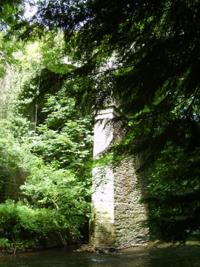
What is recorded here
Three-arch road bridge over river, built 1847. Part creeper- or ivy-covered walls centred on creeper- or ivy-covered tapered piers with corbelled stepped stringcourses supporting parapets having rubble stone rounded soldier course coping. Series of three round arches with lichen-spotted voussoirs centred on lichen-spotted keystones. Sited spanning Owenavorragh River with wooded embankments to river.
A bridge erected to a design by James Barry Farrell (1810-93), County Surveyor for County Wexford (appointed 1840; retired 1891), representing an important component of the mid nineteenth-century civil engineering heritage of north County Wexford with the architectural value of the composition, one recalling the Farrell-designed Corbally Bridge (1854), Tomnafunshoge (see 15702029); and Carrigmannon Bridge (1844), Killurin (see 15703704), confirmed not only by the sheer dressings demonstrating good quality workmanship, but also by the lofty "sweep" of the arches making a dramatic visual statement at a crossing over the Owenavorragh River: meanwhile, a discreet benchmark remains of additional interest for the connections with cartography and the preparation of maps by the Ordnance Survey (established 1824).
From the Buildings of Ireland (National Inventory of Architectural Heritage) record 15611001
This does not grant access. Most recorded buildings are privately owned; view them only from public ground unless the owner allows entry.
Places near here
Photo credits
- National Inventory of Architectural Heritage
- Lucarelli, Wikimedia Commons · CC BY-SA 3.0
- Smirkybec, Wikimedia Commons · CC BY-SA 4.0
- Ryanforsyth9, Wikimedia Commons · CC BY-SA 4.0
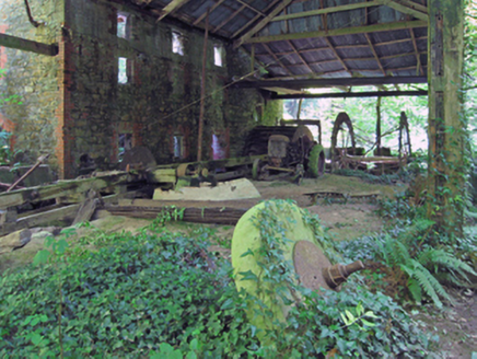 mill (water)119 ydStone CrossCross, High cross · 121 ydHigh Cross of KilbrideMonument · 134 yd
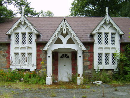 Courtown HouseGate lodge · 207 ydCourtown WoodsWood · 730 yd
 Holm Oak831 ydCourtown Amusement CentreHeritage attraction · 925 ydIndicatedCastle, motte and bailey · 1.3 miDuffcarrig Rocks BeachBeach / strand · 1.5 miBanoge HillMountain / peak · 1.5 mi
 Market HouseHeritage attraction · 2.9 mi
 1798 MonumentMemorial · 3.1 mi
More historic places in County Wexford · All of County Wexford
What do you know about this place?