DDiscover AloneMapAbout

Ballinalack Bridge, County Westmeath (WM006-075----)

Bridge

What is recorded here

No surface remains visible of the medieval bridge of Ballinalack that is depicted on the 1659 Down Survey barony maps of Moygoish and Corkaree (NLI, MS 723-4). The bridge traversed the Inny River and was situated along an important medieval routeway connecting the medieval towns of Mullingar and Longford . The terrier…

Read the whole record
No surface remains visible of the medieval bridge of Ballinalack that is depicted on the 1659 Down Survey barony maps of Moygoish and Corkaree (NLI, MS 723-4). The bridge traversed the Inny River and was situated along an important medieval routeway connecting the medieval towns of Mullingar and Longford . The terrier of the Down Survey map of Corkerry Barony recorded that ‘issuing out of the said Loughagarne is called the River Ihny upon wch is a bridge at Ballinelack wch is the cheife pass into this country’ (ibid.). The bridge was guarded by two castles (WM006-048----; WM006-049----) on the Ballinalack side which are depicted on the 1654-56 Down Survey map of Leny parish. In 1682 Sir Henry Piers of Tristernagh described Ballinalack Briddge as an 'antient and well built bridge, which having of late been very incommodious and dangerous for travellers, is now very well repaired, adorned and rendered safe for them at the charge of the county' (Vallancey 1786, 4). The present Ballinalack Bridge dates from 1874 and replaced an earlier five arch bridge. This earlier bridge was described in 1837 as, ‘situated on the banks of the River Inny, over which is a bridge of five arches, and on the road from Mullingar to Longford’ (Lewis 1837, 109). The present bridge described by the National Inventory of Architectural Heritage consists of a ‘twin-arched road bridge over River Inny, dated 1874. Now out of use and superseded by a modern bridge to the south. Constructed of coursed squared limestone rubble with rusticated rock-faced limestone voussoirs to arches and rusticated limestone copping over parapet. Projecting V-profile cut water to central pier. This bridge replaced an earlier five arch bridge located at this site, at a time when the River Inny was considerably wider at this point’(www.buildingsofireland.ie). A date-stone on the N face of the S parapet wall of the bridge bears the inscription ‘ 1874 Ballinalack Bridge Rebuilt by Upper Inny Drainage Board James Dillon Engineer’. Compiled and revised by: Caimin O’Brien Date of revised upload: 20 July 2017

From the National Monuments Service (Archaeological Survey of Ireland) record WM006-075

The monument record does not grant public access. Check the route and ask the landowner before entering private land.

Official monument number
WM006-075----
What do you know about this place?Tap to add a comment or ask a question

What you write will be public.

Places near here

Photo credits
  • National Inventory of Architectural Heritage
  • Mike Searle, Geograph · CC BY-SA 2.0
  • Stephan van Helden, Wikimedia Commons · CC BY-SA 4.0
  • Richard Webb, Geograph · CC BY-SA 2.0
  • Individual drone photographer not stated on club homepage, www.bunbrosna.com
  • Miguel Angel Masegosa Martínez, Wikimedia Commons · CC BY 2.0
  • Kmcnamee, Wikimedia Commons · CC BY-SA 4.0
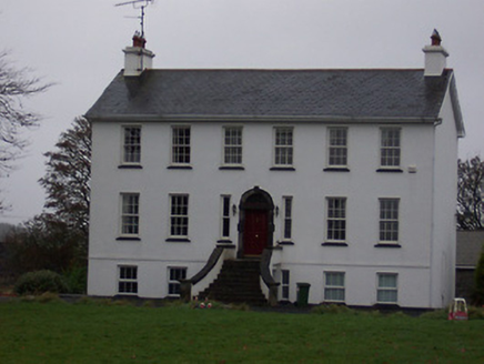
Ballinalack HouseHouse · 367 yd

Explorer Tom Ballinalack House in County Westmeath has a bad poem written about it that rhymes 'fire' with 'tire' very poorly. It…
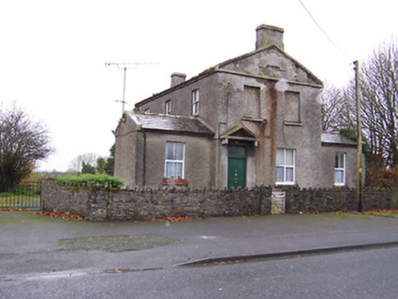
Ric barracks453 yd

Explorer Tom Ric barracks in Ballinalack swears by a superstition that says if you touch the doorframe, you won’t get fined for…

Partially hachuredFairy fort / earthen ringfort · 1.2 mi

Explorer Tom Ballyharney's fairy fort has been levelled so flat it looks like someone ironed the earth with a giant, angry shoe. It…

Crannog in Cullenhugh,lough IronCrannog · 1.3 mi

Explorer Tom Crannog in Cullenhugh, Lough Iron is stuck in the mud after the river drained away its bathwater. A canoe was found…

Carrick CastleCastle · 1.4 mi

Explorer Tom Carrick Castle is haunted by the memory of a fiddler who played all night until his fingers gave up, leaving behind…

Horse-chestnut2.6 mi

Explorer Tom Horse-chestnut in County Westmeath would bring a bag of conkers and a very strong opinion on what constitutes a good…

CastleCastle, motte · 2.6 mi

Explorer Tom Castle in Russagh handles its nosey neighbours by simply not being there anymore, which is the ultimate…

Bunbrosna GAA pitchGAA ground · 3.3 miSweet Chestnut3.5 mi

Explorer Tom Sweet Chestnut in County Westmeath has been locked in a bitter feud with the village over who left a half-eaten…

Moynihan Park, BallynacargyGAA ground · 4.0 miCarrickphilbin IslandIslet · 5.3 mi

Explorer Tom Carrickphilbin Island in County Westmeath was skipped by a bishop who just didn't fancy the walk. He probably thought…

Srudarra IslandIslet · 6.0 mi

Explorer Tom Srudarra Island has a secret talent for looking ancient while actually being brand new, I think. It’s just a name on a…

More historic places in County Westmeath · All of County Westmeath

Add to this placeAdd a picture Add a detailed tip Add a story

Explore the map1,095,414 places to discover

Next place · or swipeBallinalack House
