
What is recorded here
Ballinacaroona Bridge in Knocklong West dates from around 1810 but wears a plaque saying 1859. Taking nearly fifty years off your age is a bold move when your defence is written on a stone attached to you.
Double-arch rubble stone road bridge over the River Camogue, built c. 1810. Coursed roughly dressed stone walls with U-shaped cutwaters to south elevation. Segmental-headed arches having dressed stone voussoirs. Inscribed limestone plaque with date '1859' to south elevation.
The robust form of Ballinacaroona Bridge is indicative of high quality design, engineering and craftsmanship. Erected with a high degree of precision the bridge serves as a reminder of the skill of nineteenth-century civil engineers.
From the Buildings of Ireland (National Inventory of Architectural Heritage) record 21814013
This does not grant access. Most recorded buildings are privately owned; view them only from public ground unless the owner allows entry.
Places near here
Photo credits
- National Inventory of Architectural Heritage
- Mike Searle, Wikimedia Commons · CC BY-SA 2.0
- Colin Park, Geograph · CC BY-SA 2.0
- Hywel Williams, Geograph · Creative Commons Attribution-ShareAlike 2.0
- Colin Park, Wikimedia Commons · CC BY-SA 2.0
- Sitomon, Wikimedia Commons · CC BY-SA 2.0
 Bridge HouseFarm house · 138 yd
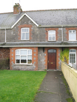 worker's house749 yd
 Castle (in ruins)Castle, tower house · 1756 ydSt Patrick's WellSpring · 1.0 miEdmund's WellSpring · 2.3 miFlat cemetery in Knockainy WestFlat cemetery · 2.7 mi
 SlievereaghMountain / peak · 4.4 mi
 Grave YardGraveyard · 4.5 mi
 Ladys WellHoly well · 5.4 mi
 Glanworth Castle (in Ruins)Castle, Anglo-Norman masonry castle · 18 mi
 European Yew26 miEuropean Yew26 mi
More historic places in County Limerick · All of County Limerick
What do you know about this place?