What is recorded here
From OpenStreetMap (© OpenStreetMap contributors) w1275426168
Places near here
Photo credits
- Eric Jones, Geograph · CC BY-SA 2.0
- Eric Jones, Wikimedia Commons · CC BY-SA 2.0
- Otter, Wikimedia Commons · CC BY-SA 4.0
- DagosNavy, Wikimedia Commons · CC BY-SA 3.0
- Ross, Wikimedia Commons · CC BY-SA 2.0
- Deathpool4 at English Wikipedia, Wikimedia Commons · Public domain
 Aughanduff Upper MountainMountain / peak · 764 yd
Explorer Tom Climb up to see the slope above Glenmore Road from this distinct peak in County Armagh, shall we?
 Ummeracam BridgeBridge · 1.1 mi
Explorer Tom Ummeracam Bridge is in a massive drama with the nearest tree because the tree keeps dropping leaves on its roof, which is really annoying for a bridge. It’s just trying to do its job while dealing with arboreal nonsense. Bring wellies and low expectations, leave delighted by the chaos.
 SlievenacappelMountain / peak · 1.3 mi
Explorer Tom Slievenacappel is part of the igneous ring dyke forming a circle around Slieve Gullion, making it one of the most prominent hills.
 Ballykeel Dolmen and CairnArchaeological place · 1.5 mi
Explorer Tom The Ballykeel Dolmen and Cairn is locally known as the Hag's Chair, an elegant Neolithic portal tomb overlooking the Forkhill River in County Armagh.
 Portal Tomb in Long Cairn With Cist: Ballykeel Dolmen in BallykeelPortal Tomb in Long Cairn With Cist: Ballykeel Dolmen · 1.5 mi
Explorer Tom Ballykeel Dolmen is a portal tomb with a cist. It looks like it’s waiting for a bus that left in 3000 BC. Sit on a wall near it and pretend you're in a painting.
 Irish Hunger StrikersMemorial · 2.2 mi
Explorer Tom This memorial for Irish Hunger Strikers is a powerful tribute to the volunteers who stood firm in H-Block for their beliefs.
 Operation ConservationMilitary operation · 2.7 mi
Explorer Tom Operation Conservation in County Armagh is just the weather having a long, bitter grudge against the military and expressing it through rain. It’s nature vs. man, but the man brought guns. Stand back, squint, and it looks like a castle, maybe?
 Creggan Freeduff Presbyterian ChurchChurch · 2.9 mi
Explorer Tom Creggan Freeduff Presbyterian Church has set a New Year's resolution to stop being so boringly dignified. The Sunday School Room suggests some serious childhood chaos occurred here. Stand where the owner stood and practise looking smug about your architectural knowledge.
 Mass Rock Loop TrailWalking route · 3.0 mi
Explorer Tom Loop around the Mass Rock Trail to find the Carrive Mass Rock shrine tucked behind the trees.
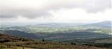 Ring of GullionRing of hills and protected landscape · 3.3 mi
Explorer Tom Ring of Gullion was Bandit Country, but now it's all about geo-tourism. It would tell a teenager that in the 1800s, everyone carried a sword and complained about the mud constantly. Look up, the best bit is always higher than you think.
 Fionn and the Cailleach: Slieve GullionLegend location · 3.3 mi
Explorer Tom Fionn and the Cailleach: Slieve Gullion begins with a lost ring in a lake. Fionn dives for it and comes up an old man, which is a steep price for being helpful. If anyone asks me to fetch jewellery from deep water, I am suddenly busy elsewhere.
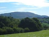 Cú Chulainn and Culann's Hound: Slieve GullionLegend location · 3.3 mi
Explorer Tom Cú Chulainn and Culann's Hound: Slieve Gullion has a boy, an attacking dog and the strangest job offer in Irish legend. Sétanta kills the hound, then volunteers to guard the smith's house himself. He certainly knew how to make an introduction. Nobody can point to the exact doorstep today.
More viewpoints and information in County Armagh · All of County Armagh

What do you know about this place?Tap to add a comment or ask a question