What is recorded here
From OpenStreetMap (© OpenStreetMap contributors) n12244109945
Places near here
Picture notes
- Computer-made picture. It does not show this mountain top.
- National Inventory of Architectural Heritage
- Computer-made picture. It does not show this monument.
- Colin Park, Geograph · CC BY-SA 2.0
- Gerard Lovett from ireland, Wikimedia Commons · CC BY 2.0
- Computer-made picture. It does not show this cliff.
- Computer-made picture. It does not show this walking route.
 Tiernan's HillMountain / peak · 996 ydComputer-made picture
Explorer Tom Tiernan's Hill in County Cavan might be quiet, but I bet it has plenty of stories to tell.
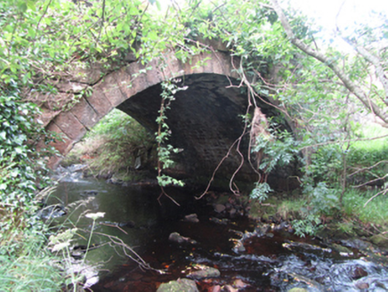 Carty’s BridgeBridge · 1566 yd
Explorer Tom Carty’s Bridge is an elegant single arch with robust construction from the early 1800s. It probably complains about modern cars constantly. Ask it how it feels about being called old.
 Fairy fort / earthen ringfort in Tullynacross (tullyhaw By.)Fairy fort / earthen ringfort · 1.1 miComputer-made picture
Explorer Tom Fairy fort / earthen ringfort in Tullynacross would write 'looking for a serious relationship with soil' on its dating profile. The ditch is filled in, so it's all smooth sailing now. Tell the kids it's a castle. Close enough.
 Mully UpperMountain / peak · 1.2 miComputer-made picture
Explorer Tom Mully Upper is a high point in County Cavan, where the name suggests you’re getting a bit higher up and seeing a bit more.
 Sweat HouseArchaeological place · 1.2 miComputer-made picture
Explorer Tom I imagine this Sweat House was very hot inside, making ancient people feel like they were baking in a giant oven.
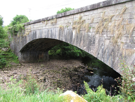 bridge1.4 mi
Explorer Tom Bridge in Gub or Garvalt Upper has an elegant arch and expertly cut ashlar. It was built with a big road project in mind. Ask it what it thinks of the potholes leading to its entrance.
 CuilcaghMountain / peak · 2.4 miComputer-made picture
Explorer Tom Cuilcagh has caught my eye in County Fermanagh. I bet a mountain / peak with a name like that could keep me talking all afternoon; I'm already inventing a daft little scene for it, and I'll stop before it turns into history.
 Cuilcagh WayWalking route · 2.9 mi
Explorer Tom Cuilcagh Way winds toward the Ulster Way, offering views of the northern slopes that are simply stunning.
 Shannon PotSpring · 3.3 mi
Explorer Tom Shannon Pot is a spring in County Cavan, where the water reflections shine so brightly that even a polarizer filter cannot hide them.
 CarrignahastaCliff · 3.5 miComputer-made picture
Explorer Tom Carrignahasta has caught my eye in County Leitrim. I bet a cliff with a name like that could keep me talking all afternoon; I'm already inventing a daft little scene for it, and I'll stop before it turns into history.
 The PlaygroundCliff · 3.5 miComputer-made picture
Explorer Tom The Playground cliff sounds like a toddler’s tantrum turned into geology! It’s just a big rocky edge in Cavan waiting for someone to slide down it. Don’t trip over your own feet while admiring the view, yeah?
 Ulster WayWalking route · 3.9 miComputer-made picture
Explorer Tom We're touching the Ulster Way here, part of a big loop that encircles Northern Ireland for the intrepid walker.
More mountains and hills in County Cavan · All of County Cavan

What do you know about this place?Tap to add a comment or ask a question