
Places near here
Photo credits
- Wikimedia Commons contributor · Public domain
- Ddoherty958, Wikimedia Commons · CC BY-SA 4.0
- Kenneth Allen, Geograph · CC BY-SA 2.0
- National Inventory of Architectural Heritage
- Kenneth Allen, Wikimedia Commons · CC BY-SA 2.0
- M'Loughlin, Peter, Wikimedia Commons
- Alistair Cunningham, Wikimedia Commons · CC BY 3.0
- Joseph Mischyshyn, Wikimedia Commons · CC BY-SA 2.0
- Keith Ruffles, Wikimedia Commons · CC BY 3.0
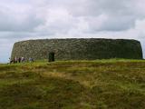 Grianán of AileachFairy fort / stone ringfort · 1.1 mi
Explorer Tom Grianán of Aileach has two roofed passages within its thick circular wall. Both curve toward the entrance and stop short. If you thought the fort was just one big ring of stone, the builders had another plan.
 Grianán of Aileach Outer HillfortHillfort · 1.1 mi
Explorer Tom Grianán of Aileach Outer Hillfort has a surprise outside the stone fort: three worn earthen rings may belong to a much older hillfort, perhaps from the Late Bronze or Iron Age. I came for one ancient place and found several piled into one hill! The long account below even traces an old road, a cairn and a holy well.
 Greenan MountainMountain / peak · 1.1 mi
Explorer Tom Greenan Mountain is a peak in County Donegal with no recorded access details. The picture looks north towards Inch Island, which makes me think the mountain is just using it as a background for its own very serious portrait.
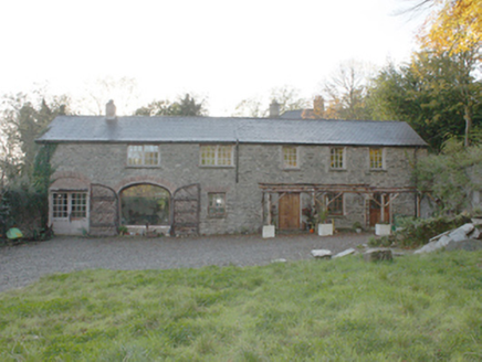 Bogay HouseOutbuilding · 1.1 mi
Explorer Tom Bogay House outbuildings are the leftovers from a big estate’s support system, including a former coach house that’s now just two pillars standing guard. It gives you an idea of how much staff they needed back then. Take a mate and argue about what it was for until you’re both tired.
 Castruse HouseHouse · 1.3 mi
Explorer Tom Castruse House hides a secret skeleton under its plaster. Local records say it was built in 1792 incorporating parts of an earlier house by the same family. I picture the old gable peeking out like a shy ghost, wondering if it still remembers who lived inside.
 When Balor Came West: The Second Battle of Mag TuiredMythic battle remembrance · 1.8 mi
Explorer Tom When Balor Came West: The Second Battle of Mag Tuired sits on flat ground below Aileach, relying entirely on Eochu Ollathair’s poem rather than archaeology. I suppose it is easier to argue with a rhyme than a shovel.
 O'Doherty's CastleRuins · 3.1 mi
Explorer Tom O'Doherty's Castle near Burt is the one that can make a confident guide point towards Buncrana and get the wrong ruin entirely. This is Burt Castle, a sixteenth-century stronghold guarding the southern approach to Inishowen, with a plan influenced by Scottish fortification design. Sir Cahir O'Doherty used it as his headquarters during his 1608 revolt. I would offer to defend the approach, then remember the fort has been a ruin for a good while and put my imaginary helmet away. The story here involves real sieges and prisoners, so keep the account straight. Check lawful access before heading for the ruin and stay off unstable masonry. Stand where you can see the ground it guarded. The view explains the choice of site quicker than any boast from me.
 Burt CastleCastle, tower house · 3.1 mi
Explorer Tom Burt Castle's roofless keep still stands on the hill, with two round corner towers and rows of gun-loops. The old account even records a spiral stair with broken steps in the south-west tower. I would admire that stubborn stonework from safe ground; those steps sound like trouble.
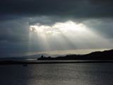 Inch Castle Promontory FortPromontory fort, coastal · 3.9 mi
Explorer Tom Inch Castle Promontory Fort sits right on Farland Bank, which is a bit of a mystery since the records are silent. But that coastal edge? I bet the wind there has been roaring since ancient times, keeping the ghosts perfectly chilled.
 Coyles barPub · 3.9 mi
Explorer Tom Coyles bar in County Donegal is probably hiding a secret stash of old pints behind the tap. I bet they serve a stout that tastes like it’s been marinating in peat for decades. Grab me a pint if you’re passing through!
 Battle of the BogsideMajor battlefield · 4.0 mi
Explorer Tom The Battle of the Bogside site has murals that tell stories louder than words ever could. One time a fox took charge of the whole situation and everyone was confused. Take a mate and argue about what it was for.
 H-Block MemorialMemorial · 4.0 mi
Explorer Tom H-Block Memorial: There’s a local who claims he invented the concept of 'monument' right here, back in the day. He’s not wrong, I guess, given how serious everyone looks about it. Great spot to propose. Or at least to propose lunch.
More mountains and hills in County Donegal · All of County Donegal

What do you know about this place?Tap to add a comment or ask a question